Varig Flight 254
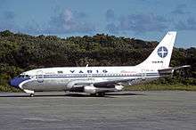 A Varig Boeing 737-200, similar to the one involved. | |
| Accident | |
|---|---|
| Date | 3 September 1989 |
| Summary | Major navigational error resulting in fuel exhaustion |
| Site |
near São José do Xingu, Brazil 10°26′40.55″S 52°39′26.90″W / 10.4445972°S 52.6574722°WCoordinates: 10°26′40.55″S 52°39′26.90″W / 10.4445972°S 52.6574722°W |
| Aircraft | |
| Aircraft type | Boeing 737–241 |
| Operator | Varig |
| Registration | PP-VMK |
| Flight origin | São Paulo–Guarulhos Int'l Airport |
| Stopover | Uberaba Airport |
| 1st stopover | Uberlândia Airport |
| 2nd stopover | Goiânia–Santa Genoveva Airport |
| 3rd stopover | Brasília International Airport |
| 4th stopover | Imperatriz Airport |
| Last stopover | Marabá Airport |
| Destination | Belém–Val de Cães Int'l Airport |
| Passengers | 48 |
| Crew | 6 |
| Fatalities | 13 |
| Injuries | 34[1] |
| Survivors | 41 |
Varig Flight 254 was a Boeing 737-241, c/n 21006/398,[2] registration PP-VMK,[3] on a scheduled passenger flight from São Paulo, Brazil, to Belém, capital city of the state of Pará in the country's North Region, on 3 September 1989. The flight had several intermediate stopovers, the last being in Marabá, Pará. Prior to takeoff from Marabá, the crew entered an incorrect heading into the flight computer, flying deep into a remote area of the Amazon jungle.[4][5] Attempts to reach an alternative airport were unsuccessful, and the plane eventually ran out of fuel,[6] making a belly landing in the jungle[7] 1,050 mi (1,690 km) northwest of Rio de Janeiro.[6] Of the 54 passengers and crew, 13 passengers died and many more sustained serious injuries.[2][8] The survivors were rescued two days later.[7]
Background
The flight was a scheduled service from São Paulo to Belém with stopovers in Uberaba, Uberlândia, Goiânia, Brasília, Imperatriz, Marabá, and finally Belém.[9] The São Paulo–Belém route had an approximate duration of eight hours and 20 minutes.[10] At 9:43, flight 254 left Guarulhos International Airport, São Paulo, heading towards Belém. The flight crew consisted of 32-year-old Captain Cézar Augusto Padula Garcez,[10] First Officer Nilson de Souza Zille, 29, and four flight attendants. The flight went smoothly through all the stops, and at 17:20, the crew was arranging the final preparations at Marabá Airport while the passengers were boarding.
Incident

While First Officer Zille was making an external inspection of the aircraft, Captain Garcez consulted the flight plan for the magnetic heading to Belém; the flight plan read 0270. Garcez interpreted this as 270 degrees, but the intended meaning was 027.0 degrees. Varig's heading notation for the flight plan was changed to four digits from three while Garcez was on vacation,[11] and it did not explicitly specify the position for the decimal point, which was implicitly located to the left of the rightmost digit. That confusion was the primary cause for the disaster, along with other minor errors. The captain therefore set the left-side Horizontal Situation Indicator (HSI) to 270 degrees, i.e. a due west course. This heading is clearly inconsistent with a route from Marabá to Belém.
After setting the HSI, Garcez programmed the aircraft performance management system (PMS)[12][13] to the distance to Belém (187 nmi or 346 km or 215 mi). The flight plan indicated an altitude of 29,000 feet (8,800 m) (FL290), and a leg duration of 48 minutes. When co-captain Zille got to his seat, instead of checking his own flight plan to adjust his HSI – as he was required to do – he only referenced the captain's indicator and set his to match it. At 17:45, flight 254 took off from Marabá, and the autopilot started a long 158° curve to port, instead of the 41 degrees heading turn to starboard that should be expected during a normal flight to Belém.
When Garcez believed the aircraft to be close to the destination, he attempted to use his VHF radio to communicate with Belém Tower. Failing to do so directly, he used another Varig airliner operating flight RG266, as a radio relay to talk to Belém Airport. When Garcez managed to establish communications with Belém, he requested descent clearance, and received it. Upon performing his descent, the captain found it very odd that he could not recognize any of the characteristic geographical features of the Belém area (such as the Marajó Island and the Amazon River estuary), and even asked the Tower Controller if the city was without electricity. In 1989, Belém airport still had no radar, and so the Controller informed Flight 254 that it was the only one in its airspace, and gave it landing clearance.
After the PMS started indicating negative distance to its destination, Captain Garcez decided to execute a 180-degree turn and locate Belém visually. He also descended the aircraft to 4,000 feet (1,200 m) and reduced its speed to 200 knots (370 km/h; 230 mph). Reluctant to use the HF radio to request help, the captain decided to take visual reference from a river he located below the plane, believing it to be the Amazon. The river was actually the Xingu, which runs chiefly south-north, while the Amazon runs west-east.
At that time, the flight had already taken 30 minutes longer than scheduled, and the passengers were getting anxious. When First Officer Zille finally noticed their initial mistake, he and the captain decided, after checking their navigation charts, to make contact with Santarém airport, believing it to be the closest airport, and made an almost 180-degree turn, now establishing a 350 magnetic course. After some calculations, Garcez realized that the aircraft did not have the necessary fuel to reach Santarém, and he started heading south again (along the now properly identified Xingu river). Finally, he decided to contact Marabá airport again, to find his location. The radio frequency of Goiânia’s locator was the same as Marabá's, and Garcez mistakenly tuned to Goiânia, located approximately 675 nmi (1,250 km; 777 mi) south of Marabá. The captain was already nervous, and he failed to notice that the tuned locator's Morse code identifier was not consistent with Marabá's beacon.
At 20:05, Belém Center called Flight 254 again demanding a report. The captain stated that he had a 170 magnetic heading to Marabá (in reality it was Goiânia), and that he was receiving a bearing from the Carajás beacon (which actually was the Barra do Garças beacon). Garcez was perplexed when Belém informed him that the Carajás beacon had been shut down since 19:30, and the Center decided to illuminate the Carajás runway in an attempt to facilitate Flight 254's orientation. Realizing that he would not have enough fuel to reach Belém, the captain decided to head for Carajás Airport, which would have been the correct decision if he had not mistaken Goiânia for Marabá. Another opportunity to solve the situation was missed at approximately 20:30, when the flight passed within 100 nautical miles (190 km; 120 mi) of the Serra do Cachimbo Air Force base, a very large airfield which the 737 could have successfully reached.
After that, it was inevitable that the aircraft would have to make a forced landing into the rainforest in the north of Mato Grosso. At the time there were no written procedures for such an emergency situation. Garcez and Zille decided to fly at 8,000 ft (2,400 m) until they ran out of fuel, thus avoiding a possible explosion upon landing, and with the engines on, they would still have hydraulic power to command the aircraft’s ailerons and flaps. They also decided to keep the plane flying slightly above stall speed, which in this case was around 150 kn (280 km/h; 170 mph). During their descent, they spotted very few lights through the jungle, coming from the houses of farms that had electrical generators. At 20:40, Garcez informed Belém center that he would be making a forced landing over the jungle. A few minutes later, when he had 15 minutes left of fuel, Garcez informed his passengers of the situation. When there was around 100 kg (220 lb) of fuel remaining, the left engine stopped. The right engine ran for a further two minutes, and then stopped as well.
Even after shutdown, the engines were still windmilling thanks to the passage of the air through them. This gave the airplane some rudimentary and unreliable hydraulic control. Garcez commanded the lowering of the flaps, which only moved to position Two, (around 10 degrees) due to the failing hydraulic system. With the batteries discharged, there was no electrical power and the only four instruments working in the cockpit were the artificial horizon, the altimeter, the airspeed indicator and the vertical speed indicator. The only thing the crew could see on the horizon were faint light spots due to distant forest burnings, and at 21:06, local time, the plane crash-landed over treetops that extended over 50 m (160 ft) above ground.
The deceleration due to the crash was such that passengers without fastened seatbelts were flung to the front of the airplane, and some seats detached from the floor, also racing forward. When the aircraft fell through the foliage, two thick trees tore away both wings, and caused a severe torsion of the fuselage, which contributed to more seats detaching, and to the collapsing of the false roof over the passengers' heads. After its speed slowed to about 35 kn (65 km/h; 40 mph), the aircraft ran for little more than 30 m (33 yd) and stopped, lying on its right side.
Search and Rescue
On 5 September, two days after the crash, Alfonso Saraiva and three other survivors started walking to look for help.[10] After about two[5] or three hours of walking in the jungle,[10] the group found the house of the Curunaré farm,[10] in São José do Xingu.[14] That farm had no radio, so they were taken by car to another farm, Serrão da Prata, reaching it around 12:30. With the help of radio operator João Capanema Jr., they were able to contact Franca Airport, 400 km (250 mi) north of São Paulo, and at 16:27 an Embraer EMB-110 Bandeirante airplane from the Brazilian Air Force (FAB) dropped food packages over the wreckage. By noon the next day, on their fourth day in the jungle, all survivors had been rescued by the FAB.
Forty one survivors were rescued from the crash site by helicopter which flew them 50 km (30 mi) to São José do Xingu, and from there they were flown by plane to Cachimbo Airport, 300 km (190 mi) to the northwest.[15] They were then flown to Brasilia Base Hospital near Brasilia.
Causes
Upon investigation, it was concluded that the crash had been caused primarily by negligence on the part of the flight crew. Customary investigations showed that the aircraft was in perfect condition for the flight, and that its mandatory periodic inspections had been properly conducted. It was concluded that the main factor for the accident was an error in reading the correct heading from the flight plan by the commander, compounded by the co-pilot copying the setting from the commander's panel instead of checking the flight plan.[2] The fact that plan course 0270 actually asked for 027.0 degrees was due to the Varig standardization of flight planning for all its fleet, but only aircraft equipped with an inertial navigation system actually used headings with decimals. Despite the pilots having been told about this peculiarity in the airline's training program, the value expressed in the flight plan 0270 was interpreted by the commander as 270° (he was on vacation during the change of standard). This misinterpretation changed the general direction north-northeast (27.0°) to west (270°). The Boeing 737 was not equipped with INS, using only automatic direction finders (ADF) and VOR.[13]
Months after the accident, the flight plan VARIG 254 used was shown to 21 pilots of major airlines in the world during a test conducted by the International Federation of Air Line Pilots' Associations (IFALPA). No fewer than 15 pilots committed the same mistake that the VARIG flight 254 crew had made. After the flight 254 accident, VARIG would install Omega navigation systems in their aircraft.[16]
Also, there were several contributing factors to the accident: the pilot did not realise he should be receiving a stronger VHF signal from Belém if he was nearing that airport, he should be receiving the local radio stations from Belém instead of other distant stations at the same frequencies, he should have checked his position and heading against the sun and geographic landmarks, and the airline's support team in Belém did not take action upon realizing the aircraft arrival was delayed.[2]
See also
- Air navigation
- Air traffic control
- Dead reckoning
- Emergency position-indicating radiobeacon station
- Flight plan
- Flight planning
- Gol Transportes Aéreos Flight 1907 – another 737 which crashed 40 miles away from Varig Flight 254's crash site
- List of airline flights that required gliding
- Navigation
- Pilot error
- Piloting (navigation)
- Situation awareness
References
- ↑ Gregg Newton (7 September 1989). "Varig Airlines Crash". Corbis. Retrieved 27 February 2011.
- 1 2 3 4 Accident description at the Aviation Safety Network. Some English text, mostly Portuguese.
- ↑ "Registro Aeronáutico Brasileiro (PP-VMK)". Agência Nacional de Aviação Civil.
- ↑ "Disparition d'un Boeing brésilien en Amazonie" [Brazilian plane disappears over the Amazon]. Le Monde (in French). Agence France-Presse. 5 September 1989. Archived from the original on 1 July 2012. Retrieved 17 July 2017.
- 1 2 "Bresil: L'accident d'un Boeing de la Varig Les rescapés de l'Amazonie" [Brazil: A Varig Boeing's accident leaves survivors in the Amazon]. Le Monde (in French). Agence France-Presse. 7 September 1989. Archived from the original on 1 July 2012. Retrieved 17 July 2017.
- 1 2 "Amazon crash survivors owe their lives to unemployed teen". Houston Chronicle. 7 September 1989. p. 16. Archived from the original on 4 July 2012.
- 1 2 Brooke, James (6 September 1989). "After Trek From Brazil Crash, Survivor Says 46 of 54 Live". The New York Times. Archived from the original on 28 July 2014.
- ↑ Germano da Silva (2008), p. 352–360.
- ↑ "Jet With 54 on Board Missing in Brazil : Disappears Over Amazon; Toll in Cuban Crash May Reach 150". Los Angeles Times. Associated Press. 5 September 1989. Archived from the original on 22 March 2015.
- 1 2 3 4 5 "46 vivem e só oito morrem no Boeing achado na mata" [46 live and only eight dead in a Boeing found in the forest]. Folha de S. Paulo (in Portuguese). 6 September 1989. Archived from the original on 4 July 2012. Retrieved 4 July 2012.
- ↑ "Vanishing Act". Mayday. Season 14. Episode 3. 2015-02-10. National Geographic Channel.
- ↑ Lowell, Norm (12 Oct 1988). Pilot`s Handbook Performance Management System for 737-200 Aircraft (02 ed.). Phoenix, AZ: Honeywell. p. 2.A-2.
- 1 2 PERALTA, PAULO FERNANDO. "Relatório Final". Cefetes. CENIPA.
- ↑ "Accident information : Boeing 737 Varig PP-VMK". Airfleets.net. Retrieved 27 February 2011.
- ↑ Lucky just to be alive, Jorge Mederos, Associated Press, published in The Free Lance Star, 7 September 1989, Page 17.
- ↑ Silva, Carlos Ari Cesar Germano da (2008). O rastro da bruxa: história da aviação comercial brasileira no século XX através de seus acidentes — 1928–1996 (The Witch trail: history of Brazilian commercial aviation in the twentieth century through its accidents - 1928-1996) (2nd ed.). Porto Alegre: EDIPUCRS. pp. 352–360. ISBN 978-85-7430-760-2.
Bibliography
- Germano da Silva, Carlos Ari César (2008). "Rumo errado". O rastro da bruxa: história da aviação comercial brasileira no século XX através dos seus acidentes 1928–1996 (in Portuguese) (2 ed.). Porto Alegre: EDIPUCRS. ISBN 978-85-7430-760-2.
External links
- (in Portuguese) Final accident report
- "O mergulho na selva" [Deep into the forest] (in Portuguese). veja.com. 13 September 1989. Archived from the original on 4 January 2013.
- Marco Aurélio Roncato de Moura's accident description in Portuguese.
- Varig Flight 254 crash site photograph
- Blackbox recording of Captain's last announcement and radio traffic in Portuguese