Vanoise massif
| Vanoise Massif | |
|---|---|
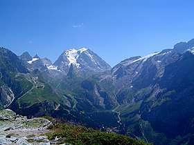 The south-west side of the Grande Casse | |
| Highest point | |
| Peak | Grande Casse |
| Elevation | 3,855 m (12,648 ft) |
| Coordinates | 45°24′19″N 6°49′39″E / 45.40528°N 6.82750°ECoordinates: 45°24′19″N 6°49′39″E / 45.40528°N 6.82750°E |
| Geography | |
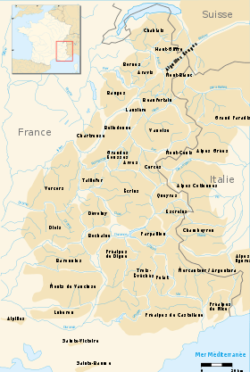 Map with subvisions of the French Alps
| |
| Country | France |
| Department | Savoie |
| Parent range | Graian Alps |
The Vanoise massif is a mountain range of the Graian Alps, located in the Western Alps. After the Mont Blanc Massif and the Massif des Écrins it is the third highest massif in France, reaching a height of 3,885m at the summit of Grande Casse. It lies between Tarentaise Valley to the north and the Maurienne valley in the south. The range is the site of France's first National Park in 1963, the Vanoise National Park. The ski resorts of Tignes and Val-d'Isère and the 2,770m high Col de l'Iseran are located in the eastern part of the range.[1]
Principal summits
The principal summits of the Vanoise massif are:
- Grande Casse, 3,855 m,
- Mont Pourri, 3,779 m
- Dent Parrachée, 3,697 m
- Grande Motte, 3,653 m
- Pointe de la Fournache, 3,642 m
- Dôme de la Sache, 3,601 m
- Dôme de l'Arpont, 3,601 m
- Dômes de la Vanoise, 3,586 m
- Dôme de Chasseforêt, 3,586 m
- Grand Roc Noir, 3,582 m
- Dôme des Nants, 3,570 m
- Aiguille de Péclet 3,561 m
- Mont Turia, 3,550 m
- Aiguille de Polset, 3,534 m
- Mont de Gébroulaz, 3,511 m
- Pointes du Châtelard 3,479 m
- Dôme des Platières, 3,473 m
- Roc des Saints Pères, 3,470 m
- Pointe de la Sana, 3,436 m
- Pointe de l'Échelle, 3,422 m
- Pointe du Bouchet, 3,420 m
- Bellecôte, 3,417 m
- Grand Bec, 3,398 m
- Pointe du Vallonnet, 3,372 m
- Pointe Rénod, 3,368 m
- Dôme des Sonnailles, 3,361 m
- Pointe de Claret, 3,355 m
- Pointe de Méan Martin, 3,330 m
- Dôme de Polset, 3,326 m
- Dôme des Pichères, 3,319 m
- Grand Roc, 3,316 m
- Roche Chevrière, 3,281 m
- Pointe de Thorens, 3,266 m
- Mont Pelve, 3,261 m
- Épaule du Bouchet, 3,250 m
- Pointe des Buffettes, 3,233 m
- Aiguille Rouge, 3,227 m
- Pointe de la Réchasse, 3,212 m
- Pointe du Dard, 3,206 m
- Aiguille de la Vanoise, 2,796 m
Principal glaciers
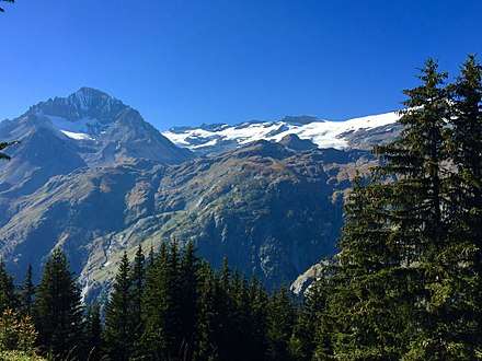
The Arpont-Chasseforêt glacier is the main glacier in the Vanoise National Park
- Glaciers de la Gurraz
- Glacier de la Savinaz
- Glacier de la Grande Motte
- Glacier de Prémou
- Glacier des Volnets
- Glacier de la Grande Casse
- Glacier de la Leisse
- Glacier des Fours
- Glacier de Méan Martin
- Glacier du Vallonnet
- Glaciers de la Vanoise (Glacier du Pelve, Glacier de l'Arpont, Glacier de la Mahure)
- Glacier de Gébroulaz
- Glacier de Thorens
- Glacier du Bouchet
- Glacier de Chavière
- Glacier de Polset
- Glacier du Geay
References
- ↑ "Vanoise - summitpost". summitpost.org. Retrieved 27 January 2015.
External links
This article is issued from
Wikipedia.
The text is licensed under Creative Commons - Attribution - Sharealike.
Additional terms may apply for the media files.