Val Veny
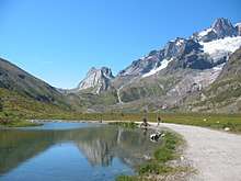
Upper Val Veny from near the refuge Élisabeth
Val Veny (also Val Vény) is a lateral valley of the Mont Blanc massif, lying to the south-west of Courmayeur. The valley head is at the Seigne Pass.
Geography
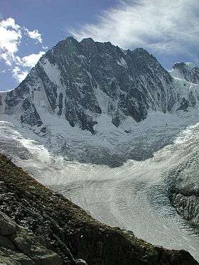
Val Veny was formed by two glaciers: the Miage Glacier and the Brenva Glacier.
Val Veny is divided into three parts:
- the part that lies parallel to the Mont Blanc massif, between the Seigne pass (2,512m) and part of the Miage Glacier
- the part called Plan Vény
- the mouth of the valley, dominated by Mont Blanc and the lower Brenva Glacier (1,444m)
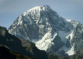
Chécrouit Lake (2,165m) lies on the right side of the Val Veny, near Courmayeur. On the opposite side you can see Mont Blanc, the Dent du Géant (4,013 m ) and the Brenva Glacier.
At the entrance of the valley lies the shrine of Our Lady of Healing (French: Notre-Dame-de-guérison).
Mountaineering
Val Veny is the starting point of the normal Italian route on Mont Blanc via the Miage Glacier and the Francesco Gonella Refuge.
Shelters and bivouacs
- Refuge Mont-Blanc - 1,700m
- Refuge Maison Vieille - 1,956m
- Refuge Élisabeth - 2,195m
- Refuge Monzino - 2,590m
- Refuge Francesco Gonella - 3,071m
- Refuge Durier - 3,358m
- Refuge Quintino Sella - 3,363m
- Bivouac Lorenzo Borelli - Carlo Pivano - 2,310m
- Bivouac Adolphe Hess - 2,958m
- Bivouac Gino Rainetto - 3,047m
- Bivouac de la Brenva - 3,060m
- Bivouac Piero Craveri - 3,490m
- Bivouac Alberico - Borgna à la Fourche - 3,680m
- Bivouac Marco Crippa - 3,850m
- Bivouac Giuseppe Lampugnani - 3,860m
See also
Coordinates: 45°47′40″N 6°54′55″E / 45.79444°N 6.91528°E
This article is issued from
Wikipedia.
The text is licensed under Creative Commons - Attribution - Sharealike.
Additional terms may apply for the media files.