Vaire-Arcier
| Vaire-Arcier | |
|---|---|
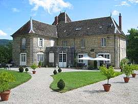 Chateau of Vaire-le-Grand | |
 Vaire-Arcier Location within Bourgogne-Franche-Comté region  Vaire-Arcier | |
| Coordinates: 47°17′02″N 6°09′11″E / 47.2839°N 6.1531°ECoordinates: 47°17′02″N 6°09′11″E / 47.2839°N 6.1531°E | |
| Country | France |
| Region | Bourgogne-Franche-Comté |
| Department | Doubs |
| Arrondissement | Besançon |
| Intercommunality | Grand Besançon |
| Government | |
| • Mayor (2008–2014) | Patrick Racine |
| Area1 | 12.78 km2 (4.93 sq mi) |
| Population (2012)2 | 531 |
| • Density | 42/km2 (110/sq mi) |
| Time zone | UTC+1 (CET) |
| • Summer (DST) | UTC+2 (CEST) |
| INSEE/Postal code | 25575 /25220 |
| Elevation | 243–561 m (797–1,841 ft) |
|
1 French Land Register data, which excludes lakes, ponds, glaciers > 1 km2 (0.386 sq mi or 247 acres) and river estuaries. 2 Population without double counting: residents of multiple communes (e.g., students and military personnel) only counted once. | |
Vaire-Arcier is a former commune in the Doubs department in the Franche-Comté region in eastern France. The communes of Vaire-le-Grand and Arcier were merged on 1 March 1974 to become Vaire-Arcier.[1] On 1 June 2016, it was merged into the new commune of Vaire.[2]
Population
| Historical population | ||
|---|---|---|
| Year | Pop. | ±% |
| 1962 | 381 | — |
| 1968 | 386 | +1.3% |
| 1975 | 384 | −0.5% |
| 1982 | 449 | +16.9% |
| 1990 | 474 | +5.6% |
| 1999 | 526 | +11.0% |
| 2008 | 515 | −2.1% |
| 2012 | 531 | +3.1% |
See also
- Château de Vaire-Le-Grand, located in Vaire-Arcier
- Vaire-le-Petit, located on the north bank of the Doubs River
References
- ↑ INSEE: Code officiel géographique (in French)
- ↑ Arrêté préfectoral 12 May 2016 (in French)
| Wikimedia Commons has media related to Vaire-Arcier. |
This article is issued from
Wikipedia.
The text is licensed under Creative Commons - Attribution - Sharealike.
Additional terms may apply for the media files.