Vache Island, Seychelles
| Nickname: Île aux Vaches Marines | |
|---|---|
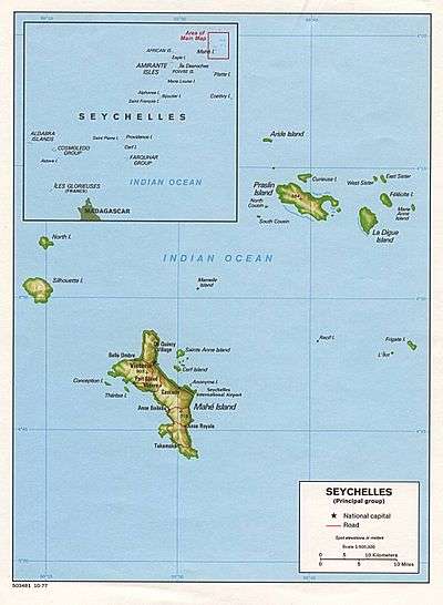
 Vache Island Location of Vache Island in Seychelles | |
| Geography | |
| Location | Seychelles, Indian Ocean |
| Coordinates | 4°41′S 55°26′E / 4.683°S 55.433°ECoordinates: 4°41′S 55°26′E / 4.683°S 55.433°E |
| Archipelago | Inner Islands, Seychelles |
| Adjacent bodies of water | Indian Ocean |
| Total islands | 1 |
| Major islands |
|
| Area | 0.047 km2 (0.018 sq mi) |
| Length | 0.2 km (0.12 mi) |
| Width | 0.25 km (0.155 mi) |
| Coastline | 0.9 km (0.56 mi) |
| Highest elevation | 54 m (177 ft) |
| Highest point | Vache |
| Administration | |
| Group | Granitic Seychelles |
| Sub-Group | Mahe Islands |
| Districts | Grand'Anse Mahé |
| Demographics | |
| Population | 0 (2014) |
| Pop. density | 0 /km2 (0 /sq mi) |
| Additional information | |
| Time zone | |
| ISO code | SC-13 |
| Official website |
www |
Île aux Vaches Marines is one of many islands in the Seychelles, lying in the west shores of Mahe.[1] Île aux Vaches Marines is a granite rock, only slightly covered with vegetation. The island is a popular nesting site for sea-birds. The rocks "Les Trois Dames" are not far from it but are usually hidden by heavily breaking seas.
Administration
The island belongs to Grand'Anse Mahé District.[2]
Image gallery
 Map 1
Map 1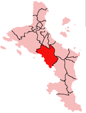 District Map
References
- ↑ Coutsoukis, Photius (2010). "Vache Island: Seychelles". geographic.org. Retrieved 25 August 2017.
- ↑ "District map" (PDF). Archived from the original (PDF) on 15 November 2008.
External links
- "Info on the island". Archived from the original on 13 April 2016. Retrieved 25 August 2017.
- "A short video documenting the removal of rats from the island". youtube.com. 21 Mar 2016. Retrieved 25 August 2017.
This article is issued from
Wikipedia.
The text is licensed under Creative Commons - Attribution - Sharealike.
Additional terms may apply for the media files.