Västmanland County
| Västmanland County Västmanlands län | |||
|---|---|---|---|
| County of Sweden | |||
| |||
 Västmanland County in Sweden | |||
 Location map of Västmanland County in Sweden | |||
| Country |
| ||
| Founded | 1634 | ||
| Capital | Västerås | ||
| Municipalities | |||
| Government | |||
| • Governor | Ingemar Skogö | ||
| • Council | Landstinget Västmanland | ||
| Area | |||
| • Total | 5,145.8 km2 (1,986.8 sq mi) | ||
| Population (September 30, 2017)[1] | |||
| • Total | 270,535 | ||
| • Density | 53/km2 (140/sq mi) | ||
| Time zone | UTC+1 (CET) | ||
| • Summer (DST) | UTC+2 (CEST) | ||
| ISO 3166 code | SE-U | ||
| GDP/ Nominal | SEK 60,287 million (2004) | ||
| GDP per capita | SEK 233,000 | ||
| NUTS Region | SE125 | ||
| Website |
www | ||


Västmanland County (Västmanlands län) is a county or län in central Sweden. It borders to the counties of Södermanland, Örebro, Gävleborg, Dalarna and Uppsala. The county also has a stretch of shoreline towards Mälaren (Sweden's third largest lake).
Province
For history, geography and culture, see: Västmanland (Westmannia)
Administration
The main aim of the County Administrative Board is to fulfil the goals set in national politics by the Riksdag and the Government, to coordinate the interests of the county, to promote the development of the county, to establish regional goals and safeguard the due process of law in the handling of each case. The County Administrative Board is a Government Agency headed by a Governor. See List of Västmanland Governors.
Politics
The County Council of Västmanland or Landstinget Västmanland.
Municipalities
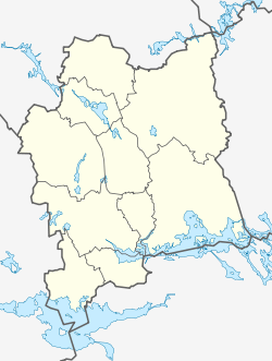
Lake at the lower right is Mälaren; at the lower left is Hjälmaren.

Heraldry
The County of Västmanland inherited its coat of arms from the province of Västmanland. When it is shown with a royal crown it represents the County Administrative Board.
Sports

Football in the county is administered by Västmanlands Fotbollförbund. Bandy is also popular, with the most successful Swedish team Västerås SK. Several Bandy World Championship finals have been played in Västerås.
References and notes
- ↑ "Folkmängd i riket, län och kommuner 30 september 2017 och befolkningsförändringar 1 juli–30 september 2017. Totalt". Statistics Sweden. 2017-11-08. Retrieved 2017-11-19.
External links
Municipalities and seats of Västmanland County | ||
|---|---|---|
| Municipalities | ||
| Municipal seats | ||
Coordinates: 59°38′44″N 16°25′28″E / 59.64554°N 16.424561°E