Örebro County
| Örebro County Örebro län | |||
|---|---|---|---|
| County of Sweden | |||
 | |||
| |||
 Örebro County in Sweden | |||
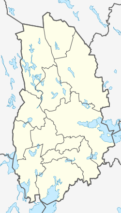 Location map of Örebro County in Sweden | |||
| Country | Sweden | ||
| Founded | 1634 | ||
| Capital | Örebro | ||
| Municipalities | |||
| Government | |||
| • Governor | Maria Larsson | ||
| • Council | Landstinget i Örebro | ||
| Area | |||
| • Total | 8,545.6 km2 (3,299.5 sq mi) | ||
| Population (30 September 2017)[1] | |||
| • Total | 297,997 | ||
| • Density | 35/km2 (90/sq mi) | ||
| Time zone | UTC+1 (CET) | ||
| • Summer (DST) | UTC+2 (CEST) | ||
| ISO 3166 code | SE-T | ||
| GDP/ Nominal | SEK 61,203 million (2004) | ||
| GDP per capita | SEK 224,000 | ||
| NUTS Region | SE124 | ||
| Website |
www | ||


Örebro County (Swedish: Örebro län) is a county or län in central Sweden. It borders the counties of Västra Götaland, Värmland, Dalarna, Västmanland, Södermanland and Östergötland. It is frequently culturally divided into the hilly northern region of Bergslagen, where mining and metallurgic industry have been important since the Middle Ages, and the southern Mälardalen of lakes and farms.[2]
Province
Sweden's counties are primarily administrative units, whereas the provinces of Sweden usually fit cultural and historical boundaries. Örebro County consists of the province of Närke, the western half of Västmanland and minor parts of eastern Värmland and northeastern Västergötland. Örebro County is named after its capital city, Örebro, which in 2010 was the sixth largest city of Sweden. Official 2010 numbers sourced in the localities section indicate that 38% of the county population is living in the city of Örebro alone. Örebro itself contains just as many inhabitants as the 23 other largest localities put together, and has grown significantly ever since the official statistics began in the late 1960s.
Administration
The county was named Närke and Värmland County until 1779 when Värmland County seceded.
The main aim of the County Administrative Board is to fulfil the goals set in national politics by the Riksdag and the Government, to coordinate the interests of the county, to promote the development of the county, to establish regional goals and safeguard the due process of law in the handling of each case. The County Administrative Board is a Government Agency headed by a Governor. See List of Örebro Governors.
Politics
The County Council of Örebro or Örebro läns landsting, which is appointed by the electorate of the county, is primarily responsible for health care and public transportation.
Geography and climate
The southern Närke plain, the forested north and the highland to the west makes for a varying landscape. Örebro County is located between the four major lakes of Sweden and has coastlines on two of them. Capital Örebro is alongside Hjälmaren, located slightly inland along Svartån. The southern area of the county has a transitional climate between oceanic and continental, with warm summers and cold, variable winters. Örebro has a July high of around 23 °C (73 °F) and winter highs around 0 °C (32 °F) with frosts being frequent from November to April. The proximity to the major lakes moderates winter temperatures somewhat, undermining the continental effects of its inland position. The northern areas of the county are slightly cooler year-round. The summer temperatures on the Närke Plain are some of the warmest in all of Scandinavia and by extension Northern Europe.
Municipalities

Örebro County is divided into 12 municipalities.[2][3]
| Municipality | Population (2017) | ||||||||||||||||||||||||||||
|---|---|---|---|---|---|---|---|---|---|---|---|---|---|---|---|---|---|---|---|---|---|---|---|---|---|---|---|---|---|
| Askersund | 11,175 | ||||||||||||||||||||||||||||
| Degerfors | 9,668 | ||||||||||||||||||||||||||||
| Hällefors | 7,109 | ||||||||||||||||||||||||||||
| Hallsberg | 15,932 | ||||||||||||||||||||||||||||
| Karlskoga | 30,413 | ||||||||||||||||||||||||||||
| Kumla | 21,506 | ||||||||||||||||||||||||||||
| Laxå | 5,643 | ||||||||||||||||||||||||||||
| Lekeberg | 7,868 | ||||||||||||||||||||||||||||
| Lindesberg | 23,613 | ||||||||||||||||||||||||||||
| Ljusnarsberg | 3,016 | ||||||||||||||||||||||||||||
| Nora | 10,747 | ||||||||||||||||||||||||||||
| Örebro | 150,291 | ||||||||||||||||||||||||||||
| Source: Statistics Sweden[4] | |||||||||||||||||||||||||||||
Localities (2010 Statistics Sweden estimate)
| Pos | Locality | Population | |||||||||||||||||||||||||||
|---|---|---|---|---|---|---|---|---|---|---|---|---|---|---|---|---|---|---|---|---|---|---|---|---|---|---|---|---|---|
| 1 | Örebro | 107,036 | |||||||||||||||||||||||||||
| 2 | Karlskoga | 27,084 | |||||||||||||||||||||||||||
| 3 | Kumla | 14,062 | |||||||||||||||||||||||||||
| 4 | Lindesberg | 9,149 | |||||||||||||||||||||||||||
| 5 | Degerfors | 7,160 | |||||||||||||||||||||||||||
| 6 | Hallsberg | 7,124 | |||||||||||||||||||||||||||
| 7 | Nora | 6,526 | |||||||||||||||||||||||||||
| 8 | Hällefors | 4,530 | |||||||||||||||||||||||||||
| 9 | Askersund | 3,887 | |||||||||||||||||||||||||||
| 10 | Laxå | 3,064 | |||||||||||||||||||||||||||
| 11 | Kopparberg | 3,016 | |||||||||||||||||||||||||||
| 12 | Hovsta | 2,785 | |||||||||||||||||||||||||||
| 13 | Frövi | 2,516 | |||||||||||||||||||||||||||
| 14 | Fjugesta | 2,033 | |||||||||||||||||||||||||||
| 15 | Storå | 1,933 | |||||||||||||||||||||||||||
| 16 | Hällabrottet | 1,789 | |||||||||||||||||||||||||||
| 17 | Garphyttan | 1,619 | |||||||||||||||||||||||||||
| 18 | Pålsboda | 1,552 | |||||||||||||||||||||||||||
| 19 | Fellingsbro | 1,384 | |||||||||||||||||||||||||||
| 20 | Odensbacken | 1,374 | |||||||||||||||||||||||||||
| 21 | Vintrosa | 1,343 | |||||||||||||||||||||||||||
| 22 | Ekeby-Almby | 1,271 | |||||||||||||||||||||||||||
| 23 | Åsbro | 1,164 | |||||||||||||||||||||||||||
| 24 | Sköllersta | 1,131 | |||||||||||||||||||||||||||
| Source: Statistics Sweden[5] | |||||||||||||||||||||||||||||
Heraldry
The arms for the County of Örebro is a combination of the arms of Närke, Västmanland and Värmland. When it is shown with a royal crown it represents the County Administrative Board.
See also
- Duke of Närke, a title for members of the royal family (see Duchies in Sweden)
References and notes
- ↑ "Folkmängd i riket, län och kommuner 30 september 2017 och befolkningsförändringar 1 juli–30 september 2017. Totalt". Statistics Sweden. 2017-11-08. Retrieved 2017-11-19.
- 1 2 "Örebro län; Fakta & Perspectiv". Regionfakta. Pantzare Information. Retrieved 8 October 2018.
- ↑ "Örebro län". Information om Sverige. County Administrative Board of Västra Götaland. 2016. Retrieved 8 October 2018.
- ↑ "Population by region and year". Statistics Sweden. Retrieved 7 October 2018.
- ↑ Statistics Sweden http://www.scb.se/Statistik/MI/MI0810/2010A01Z/05_Tatorter2010_befolkning_1960_2010.xls. Missing or empty
|title=(help)
External links
| Wikimedia Commons has media related to Örebro County. |
Municipalities and seats of Örebro County | ||
|---|---|---|
| Municipalities | ||
| Municipal seats | ||
Coordinates: 59°16′00″N 15°13′00″E / 59.266667°N 15.216667°E