Utting
| Utting a.Ammersee | ||
|---|---|---|
| ||
 Utting a.Ammersee Location of Utting a.Ammersee within Landsberg am Lech district 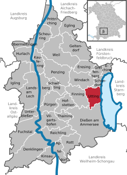 | ||
| Coordinates: 48°2′N 11°5′E / 48.033°N 11.083°ECoordinates: 48°2′N 11°5′E / 48.033°N 11.083°E | ||
| Country | Germany | |
| State | Bavaria | |
| Admin. region | Oberbayern | |
| District | Landsberg am Lech | |
| Government | ||
| • Mayor | Josef Lutzenberger (Grüne Alternative Liste) | |
| Area | ||
| • Total | 19.03 km2 (7.35 sq mi) | |
| Elevation | 554 m (1,818 ft) | |
| Population (2017-12-31)[1] | ||
| • Total | 4,529 | |
| • Density | 240/km2 (620/sq mi) | |
| Time zone | CET/CEST (UTC+1/+2) | |
| Postal codes | 86919 | |
| Dialling codes | 08806 | |
| Vehicle registration | LL | |
| Website | www.utting.de | |

Utting is a municipality in the district of Landsberg in Bavaria in Germany.
History
During World War II, a subcamp of Dachau concentration camp was located in the town.[2]
External links
- European Holocaust Memorial - a monument ensemble against racism and totalitarianism at the place of the crime - under the executive management of the Citizens´ Association European Holocaust Memorial Foundation
- The Holocaust in the Landsberg area- Citizens´ Association "Landsberg in the 20th Century" (English)
References
This article is issued from
Wikipedia.
The text is licensed under Creative Commons - Attribution - Sharealike.
Additional terms may apply for the media files.