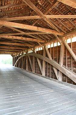
Utica Covered Bridge
|
Utica Covered Bridge | |
 | |
  | |
| Location | Utica Rd. at Fishing Creek, Thurmont, Maryland |
|---|---|
| Coordinates | 39°31′28″N 77°23′46″W / 39.52444°N 77.39611°WCoordinates: 39°31′28″N 77°23′46″W / 39.52444°N 77.39611°W |
| Area | 0.2 acres (0.081 ha) |
| Built | 1860 |
| Architectural style | Burr arch truss |
| MPS | Covered Bridges in Frederick County TR |
| NRHP reference # | 78003174[1] |
| Added to NRHP | June 23, 1978 |
The Utica Road Covered Bridge is a Burr truss wooden covered bridge located near Lewistown, Maryland. Originally built in 1834, it spanned the Monocacy River at the Devilbiss Bridge crossing. An 1889 flood damaged the bridge and the surviving half was moved to Fishing Creek in 1891. Like the nearby Loys Station Covered Bridge, a pier was inserted at the middle of the bridge to halve its span.[2]
The Utica Covered Bridge was listed on the National Register of Historic Places in 1978.[1]
References
- 1 2 National Park Service (2010-07-09). "National Register Information System". National Register of Historic Places. National Park Service.
- ↑ Cherilyn Widell (August 1977). "National Register of Historic Places Registration: Utica Covered Bridge" (PDF). Maryland Historical Trust. Retrieved 2016-01-01.
External links
| Wikimedia Commons has media related to Utica Covered Bridge. |
- Utica Covered Bridge, Frederick County, including photo in 1980, at Maryland Historical Trust
| Topics |  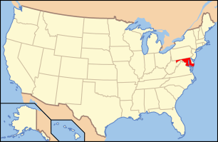 | |
|---|---|---|
| Lists by county | ||
| Lists by city | ||
| Other lists | ||
| ||
This article is issued from
Wikipedia.
The text is licensed under Creative Commons - Attribution - Sharealike.
Additional terms may apply for the media files.