Urvich Wall
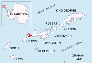

Urvich Wall (Bulgarian: Урвичка стена, ‘Urvichka Stena’ \'ur-vich-ka ste-'na\) is the narrow ice-free and crescent-shaped ridge rising to 121 m on Livingston Island in the South Shetland Islands, Antarctica and bounded by Nedelya Point to the north and Rish Point to the southeast. Extending 6.7 km and up to 400 m wide, the ridge separates Byers Peninsula to the west from Rotch Dome to the east.
The ridge is named after the medieval fortress of Urvich in Plana Mountain, Bulgaria.
Location
Urvich Wall is centred at 62°38′50.5″S 61°57′45.8″W / 62.647361°S 61.962722°WCoordinates: 62°38′50.5″S 61°57′45.8″W / 62.647361°S 61.962722°W. Spanish mapping in 1992, and Bulgarian in 2005 and 2009.
Maps
- Península Byers, Isla Livingston. Mapa topográfico a escala 1:25000. Madrid: Servicio Geográfico del Ejército, 1992.
- L.L. Ivanov et al. Antarctica: Livingston Island and Greenwich Island, South Shetland Islands. Scale 1:100000 topographic map. Sofia: Antarctic Place-names Commission of Bulgaria, 2005.
- L.L. Ivanov. Antarctica: Livingston Island and Greenwich, Robert, Snow and Smith Islands. Scale 1:120000 topographic map. Troyan: Manfred Wörner Foundation, 2009. ISBN 978-954-92032-6-4
- Antarctic Digital Database (ADD). Scale 1:250000 topographic map of Antarctica. Scientific Committee on Antarctic Research (SCAR). Since 1993, regularly upgraded and updated.
- L.L. Ivanov. Antarctica: Livingston Island and Smith Island. Scale 1:100000 topographic map. Manfred Wörner Foundation, 2017. ISBN 978-619-90008-3-0
References
- Urvich Wall. SCAR Composite Gazetteer of Antarctica.
- Bulgarian Antarctic Gazetteer. Antarctic Place-names Commission. (details in Bulgarian, basic data in English)
This article includes information from the Antarctic Place-names Commission of Bulgaria which is used with permission.