Rish Point
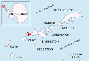

Rish Point (Bulgarian: нос Риш, ‘Nos Rish’ \'nos 'rish\) is an ice-free point projecting 300 m from the south coast of Livingston Island in the South Shetland Islands, Antarctica. Situated at the east extremity of South Beaches, Byers Peninsula, 2.3 km northwest of Amadok Point, 1.3 km southwest of Clark Nunatak, and 1 km northeast of Stackpole Rocks.
The point is named after the settlement of Rish in the eastern Balkan Mountains, Bulgaria.
Location
Rish Point is located at 62°40′21″S 60°55′55″W / 62.67250°S 60.93194°WCoordinates: 62°40′21″S 60°55′55″W / 62.67250°S 60.93194°W. British mapping in 1968, Spanish in 1993, and Bulgarian in 2005 and 2009.
Map
- L.L. Ivanov. Antarctica: Livingston Island and Greenwich, Robert, Snow and Smith Islands. Scale 1:120000 topographic map. Troyan: Manfred Wörner Foundation, 2009. ISBN 978-954-92032-6-4
References
- Rish Point. SCAR Composite Gazetteer of Antarctica.
- Bulgarian Antarctic Gazetteer. Antarctic Place-names Commission. (details in Bulgarian, basic data in English)
This article includes information from the Antarctic Place-names Commission of Bulgaria which is used with permission.