Unterrabnitz-Schwendgraben
| Unterrabnitz-Schwendgraben | ||
|---|---|---|
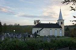 Church of Saints Peter and Paul in Unterrabnitz | ||
| ||
 Unterrabnitz-Schwendgraben Location within Austria | ||
| Coordinates: 47°27′N 16°23′E / 47.450°N 16.383°ECoordinates: 47°27′N 16°23′E / 47.450°N 16.383°E | ||
| Country | Austria | |
| State | Burgenland | |
| District | Oberpullendorf | |
| Government | ||
| • Mayor | Franz Haspel (ÖVP) | |
| Area | ||
| • Total | 13.9 km2 (5.4 sq mi) | |
| Population (1 January 2016)[1] | ||
| • Total | 646 | |
| • Density | 46/km2 (120/sq mi) | |
| Time zone | UTC+1 (CET) | |
| • Summer (DST) | UTC+2 (CEST) | |
| Postal code | 7371 | |

Unterrabnitz-Schwendgraben (Croatian: Dolnji Ramac, Hungarian: Alsórámóc-Répcefő) is a town in the district of Oberpullendorf in the Austrian state of Burgenland.
Population
| Historical population | ||
|---|---|---|
| Year | Pop. | ±% |
| 1869 | 857 | — |
| 1880 | 863 | +0.7% |
| 1890 | 805 | −6.7% |
| 1900 | 749 | −7.0% |
| 1910 | 786 | +4.9% |
| 1923 | 745 | −5.2% |
| 1934 | 725 | −2.7% |
| 1939 | 655 | −9.7% |
| 1951 | 624 | −4.7% |
| 1961 | 586 | −6.1% |
| 1971 | 591 | +0.9% |
| 1981 | 628 | +6.3% |
| 1991 | 601 | −4.3% |
| 2001 | 634 | +5.5% |
| 2011 | 659 | +3.9% |
References
- ↑ Statistik Austria - Bevölkerung zu Jahresbeginn 2002-2016 nach Gemeinden (Gebietsstand 2016-01-01) for Unterrabnitz-Schwendgraben.
.jpg)
This article is issued from
Wikipedia.
The text is licensed under Creative Commons - Attribution - Sharealike.
Additional terms may apply for the media files.