Unterfrauenhaid
| Unterfrauenhaid | ||
|---|---|---|
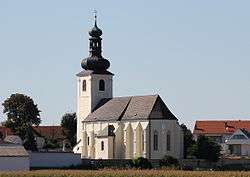 Church of the Assumption of the Virgin Mary | ||
| ||
 Unterfrauenhaid Location within Austria | ||
| Coordinates: 47°34′N 16°30′E / 47.567°N 16.500°ECoordinates: 47°34′N 16°30′E / 47.567°N 16.500°E | ||
| Country | Austria | |
| State | Burgenland | |
| District | Oberpullendorf | |
| Government | ||
| • Mayor | Friedrich Kreisits (SPÖ) | |
| Area | ||
| • Total | 11.0 km2 (4.2 sq mi) | |
| Population (1 January 2016)[1] | ||
| • Total | 689 | |
| • Density | 63/km2 (160/sq mi) | |
| Time zone | UTC+1 (CET) | |
| • Summer (DST) | UTC+2 (CEST) | |
| Postal code | 7321 | |

Unterfrauenhaid (Croatian: Svetica, Hungarian: Lók) is a town in the district of Oberpullendorf in the Austrian state of Burgenland.
Population
| Historical population | ||
|---|---|---|
| Year | Pop. | ±% |
| 1869 | 528 | — |
| 1880 | 556 | +5.3% |
| 1890 | 491 | −11.7% |
| 1900 | 565 | +15.1% |
| 1910 | 599 | +6.0% |
| 1923 | 686 | +14.5% |
| 1934 | 713 | +3.9% |
| 1939 | 667 | −6.5% |
| 1951 | 683 | +2.4% |
| 1961 | 681 | −0.3% |
| 1971 | 615 | −9.7% |
| 1981 | 685 | +11.4% |
| 1991 | 691 | +0.9% |
| 2001 | 759 | +9.8% |
| 2011 | 664 | −12.5% |
References
This article is issued from
Wikipedia.
The text is licensed under Creative Commons - Attribution - Sharealike.
Additional terms may apply for the media files.