Ummera
Ummera is a townland in the Civil Parish of Tomregan, Barony of Knockninny, County Fermanagh, Northern Ireland.
Etymology
The townland name is an anglicisation of the Gaelic placename “Iomaire” which means ‘The Hill-Ridge’.[1]
Geography
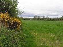
It is bounded on the north by Gortaree townland, on the east by Aghindisert and Drumderg townlands, on the south by Gortineddan townland and on the west by Gortmullan and Knockateggal townlands. Its chief geographical feature is a drumlin hill reaching to 60 metres above sea-level. The townland is traversed by the B127 Border Road to Ballyconnell and the C431 Teemore Road. Ummera covers an area of 107 statute acres.
History
The townland formed part of the ballybethagh of Calvagh in medieval times. At the beginning of the 17th century it was owned jointly by Bryan McPhilip O’Reyly and Edward Rutlidge but was confiscated by the Crown in the 1609 Ulster Plantation and it formed part of the half-territory of Aughrin which was granted to Sir Hugh Culme in 1610. Culme later relinquished his claim to the Crown, perhaps because there was confusion at the time as to whether the townland formed part of County Fermanagh or County Cavan. By an order of the Lord Deputy dated 14 October 1612 the townland was granted, inter alia, to Lady Margaret O’Neill, the widow of Sir Hugh Maguire deceased.
The Tithe Applotment Books for 1827 list the following tithepayers in the townland- McKenna, Crawford, Cosgrove, Wallace, Ross, McGee.[2]
In 1841 the population of the townland was 81, being 40 males and 41 females. There were thirteen houses in the townland, all were inhabited.[3]
In 1851 the population of the townland was 56, being 30 males and 26 females, the reduction being due to the Great Famine (Ireland). There were ten houses in the townland, all were inhabited.[4]
Griffith's Valuation of 1857 lists twelve occupiers in the townland.[5]
In 1861 the population of the townland was 46, being 20 males and 26 females. There were eleven houses in the townland, of which one was uninhabited.[6]
In 1871 the population of the townland was 59, being 28 males and 31 females. There were ten houses in the townland and all were inhabited.(page 606 of census)[7]
In 1881 the population of the townland was 50, being 22 males and 28 females. There were ten houses in the townland, all were inhabited.[8]
In 1891 the population of the townland was 55, being 27 males and 28 females. There were nine houses in the townland, all were inhabited.[9]
In the 1901 census of Ireland, there are ten families listed in the townland.[10]
In the 1911 census of Ireland, there are nine families listed in the townland.[11]
Antiquities
There are no historic sites in the townland.
References
External links