Stac Fada Member
| Stac Fada Member Stratigraphic range: Mesoproterozoic | |
|---|---|
 Accretionary lapilli from the Stac Fada Member | |
| Type | Member |
| Unit of | Bay of Stoer Formation, Stoer Group |
| Underlies | Poll a' Mhuilt Member |
| Thickness | 10 to 15 m [1] |
| Location | |
| Country | Scotland |
| Extent | 55 km along the coast of NW Scotland |
| Type section | |
| Named for | Stac Fada, a small headland west of Stoer |
The Stac Fada Member is a distinctive layer towards the top of the Mesoproterozoic Bay of Stoer Formation, part of the Torridonian Supergroup. This rock unit is generally 10 to 15 metres thick and is made of sandstone that contains accretionary lapilli and many dark green glassy fragments of mafic composition.[1]
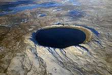
Evidence for a bolide impact near Ullapool or Lairg has been published and refined in studies in 2008 and 2015. It is prospectively among the twenty largest impact craters on Earth, is 40 km across, and dates from 1.2 billion years ago.
Interpretation
Evidence for a bolide impact close to Ullapool was published by a combined team of scientists from the University of Oxford and the University of Aberdeen, in March 2008.[2] Additional evidence for an impact origin for the deposit comes from the identification of the mineral Reidite as lamellae in Zircon grains, indicating pressures of at least 30 GPa.[3]
The evidence is centred on Ullapool, a harbour town on Loch Broom in the Ross and Cromarty district of the Highland council area of northwest Scotland. It may have been the largest known bolide impact ever to strike what are now the British Isles. The impact, which has been dated to about 1.18 Ga,[4] melted rock at the site and left parallel shock fractures in quartz and biotite and a tell-tale trace of iridium. Centered on the impact crater, a wide ejecta field has been traced, some 50 km across, forming the Stac Fada Member within the Stoer Group of the Torridonian. The affected layer of rock, which on land stretches from Gairloch in the south to Stoer in the north is six to 22 metres thick.[5] Before 2008, this anomalous unit was unsatisfactorily credited to an isolated instance of volcanism.
The crater, preserved under sedimentary layers of sandstone, is currently presumed to either lie to the west under the Minch, the waterway that separates the Isle of Lewis in the Outer Hebrides from the north-west Highlands of Scotland, or to be the cause of the Lairg Gravity Low, beneath the Moine Thrust Belt to the east.[6] It has been estimated that the crater is about 10 km across.[5] The impact would have created a blast with the force of 145,000 megatons and that the shock wave would have created winds of 420 km/h as far away as the site of modern Aberdeen.[5]
See also
- Silverpit crater, the only other proposed impact crater in or near the British Isles.
- Impact event
- List of impact craters on Earth
- North West Highlands Geopark
- Geology of Scotland
References
- 1 2 "Stac Fada Member". The BGS Lexicon of Named Rock Units. British Geological Survey. Retrieved 23 March 2016.
- ↑ "Britain's biggest meteorite impact found" (Press release). University of Aberdeen. 26 March 2008. Retrieved 22 March 2015.
- ↑ Reddy S.M.; Johnson T.E.; Fischer S.; Rickard W.D.A.; Taylor R.J.M. (2015). "Precambrian reidite discovered in shocked zircon from the Stac Fada impactite, Scotland". Geology. 43 (10): 899–902. Bibcode:2015Geo....43..899R. doi:10.1130/G37066.1.
- ↑ Parnell, J.; Mark, D.; Fallick, A.E.; Boyce, A.; Thackrey, S. (2011). "The age of the Mesoproterozoic Stoer Group sedimentary and impact deposits, NW Scotland". Journal of the Geological Society. 168 (2): 349–358. doi:10.1144/0016-76492010-099.
- 1 2 3 Urquhart, Frank (27 March 2008). "Discovery with deep impact on Scots coast". The Scotsman. Johnston Press. Retrieved 21 March 2015.
- ↑ Simms, Michael J. (December 2015). "The Stac Fada impact ejecta deposit and the Lairg Gravity Low: evidence for a buried Precambrian impact crater in Scotland?" (PDF). Proceedings of the Geologists' Association. 126 (6): 742–761. doi:10.1016/j.pgeola.2015.08.010. Retrieved 5 April 2017.
- Amor, Kenneth; Hesselbo, Stephen P.; Porcelli, Don; Thackrey, Scott; Parnell, John (March 2008). "A Precambrian proximal ejecta blanket from Scotland". Geology. 36 (4): 303–306. Bibcode:2008Geo....36..303A. doi:10.1130/G24454A.1.