Ulan, New South Wales
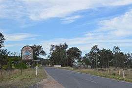
Ulan is a small village in eastern New South Wales, Australia. Ulan Post Office opened on 1 September 1893.[1]
There is a coal mine at Ulan. The Sandy Hollow - Ulan Railway was built to serve this coal mine. In exchange for additional coal leases, the coal company extended the railway for 20 km to connect with other railway lines at Gulgong thus forming an improved alternate route crossing the Great Dividing Range at a lower altitude with improved gradients.
Ulan is situated on the edges of the Sydney basin.
Ulan railway station
| Preceding station | NSW Branch lines | Following station | ||
|---|---|---|---|---|
Terminus | Sandy Hollow – Gulgong Line | Akuna towards Sandy Hollow |
References
- ↑ Premier Postal History. "Post Office List". Premier Postal Auctions. Archived from the original on 2008-08-19. Retrieved 2011-05-26.
External links
![]()
This article is issued from
Wikipedia.
The text is licensed under Creative Commons - Attribution - Sharealike.
Additional terms may apply for the media files.