Tuscola Area Airport
| Tuscola Area Airport | |||||||||||||||
|---|---|---|---|---|---|---|---|---|---|---|---|---|---|---|---|
| Summary | |||||||||||||||
| Airport type | Public | ||||||||||||||
| Owner | Tuscola Area Airport Authority | ||||||||||||||
| Serves | Caro, Michigan, United States | ||||||||||||||
| Elevation AMSL | 701 ft / 214 m | ||||||||||||||
| Coordinates | 43°27′31″N 083°26′43″W / 43.45861°N 83.44528°WCoordinates: 43°27′31″N 083°26′43″W / 43.45861°N 83.44528°W | ||||||||||||||
| Website | www.flytaa.org | ||||||||||||||
| Map | |||||||||||||||
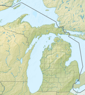 CFS Location of airport in Michigan  CFS CFS (the US) | |||||||||||||||
| Runways | |||||||||||||||
| |||||||||||||||
| Statistics (2008) | |||||||||||||||
| |||||||||||||||
Tuscola Area Airport (IATA: TZC, ICAO: KCFS, FAA LID: CFS, formerly 78D) is a public use airport located three nautical miles (6 km) southwest of the central business district of Caro, a city in Tuscola County, Michigan, United States. It is owned by the Tuscola Area Airport Authority.[1] It is included in the Federal Aviation Administration (FAA) National Plan of Integrated Airport Systems for 2017–2021, in which it is categorized as a local general aviation facility.[2] Although many U.S. airports use the same three-letter location identifier for the FAA and IATA, this airport is assigned CFS by the FAA but has been assigned TZC from the IATA. [3] Note that CFS was assigned to Coffs Harbour Airport in Coffs Harbour, New South Wales, Australia.[4]
Facilities and aircraft
Tuscola Area Airport covers an area of 260 acres (110 ha) at an elevation of 701 feet (214 m) above mean sea level. It has two runways: 5/23 is 4,300 by 75 feet (1,311 x 23 m) with an asphalt pavement; 12/30 is 2,300 by 110 feet (701 x 34 m) with a turf surface.[1] The airport is not staffed regularly.
For the 12-month period ending December 31, 2008, the airport had 10,200 general aviation aircraft operations, an average of 27 per day. At that time there were 48 aircraft based at this airport: 85.4% single-engine, 4.2% multi-engine, 2.1% jet and 8.3% helicopter.[1]
Transit
The airport is accessible by road from M-81, and is close to M-24.
References
- 1 2 3 4 FAA Airport Master Record for CFS (Form 5010 PDF). Federal Aviation Administration. effective 8 April 2010.
- ↑ "List of NPIAS Airports" (PDF). FAA.gov. Federal Aviation Administration. 21 October 2016. Retrieved 25 November 2016.
- ↑ Airport information for KCFS at Great Circle Mapper.
- ↑ "Coffs Harbour, New South Wales, Australia (IATA: CFS)". Great Circle Mapper. Retrieved 23 May 2010.
External links
- "Tuscola Area Airport (78D)" (PDF). (49.5 KB) at Michigan DOT Airport Directory
- Aerial image as of 27 March 1999 from USGS The National Map
- FAA Terminal Procedures for CFS, effective October 11, 2018
- Resources for this airport:
- FAA airport information for CFS
- AirNav airport information for KCFS
- FlightAware airport information and live flight tracker
- NOAA/NWS latest weather observations
- SkyVector aeronautical chart, Terminal Procedures