Tumsar
| Tumsar तुमसर | |
|---|---|
| city | |
 Tumsar Location in Maharashtra, India | |
| Coordinates: 21°22′50″N 79°44′50″E / 21.38056°N 79.74722°ECoordinates: 21°22′50″N 79°44′50″E / 21.38056°N 79.74722°E | |
| Country |
|
| State | Maharashtra |
| District | Bhandara |
| Named for | Rice farms, Cereal market |
| Government | |
| • MLA | Charan Waghmare |
| Area | |
| • Total | 30.00 km2 (11.58 sq mi) |
| Elevation | 272 m (892 ft) |
| Population (2011)[1][2] | |
| • Total |
Tumsar: 42,021 Tumsar Taluka: 213,843 |
| Languages | |
| • Official | Marathi Hindi |
| Time zone | UTC+5:30 (IST) |
| PIN | 441912 |
| Telephone code | 91-7183 |
| Vehicle registration | MH36 |
| Website | Tumsar my city app |
Tumsar is a town in the Bhandara district in the Indian state of Maharashtra.
Tumsar is a city and municipal council in Bhandara district in the Indian state of Maharashtra. The city's name comes from a fish, "Tum", that was discovered in lakes of the area.
Tumsar is approximately 6 km from the Wainganga River, 30 km from Bhandara, 95 km From Nagpur, 65 km from Gondia and 300 km from Jabalpur (Madhya Pradesh). It is 700 km from Bhopal, 920 km from Delhi, 1000 km from Kolkata and 980 km from Mumbai and Indore.The town has several lakes. Tumsar once had a severe drinking water crisis, but later drinking water from the Vainganga was directed to the town.
Languages Spoken
- Marathi [मराठी] is the official and most spoken primary language. Hindi is usually understood, and also spoken secondarily.
Road Transportation
Tumsar is directly connected to Nagpur and Raipur by Private and Government Bus Services. It is one of division of MSRTC.It has also a very good connectivity with neighbouring Madhya Pradesh.
Rail Transportation
Tumsar Road railway station serves Bhandara City and its outgrowth. It is directly connected to state capital Mumbai and Kolkata by Indian Railway. Tumsar is connected to both Raipur and Nagpur for rail transportation. Tumsar Road railway station, is one of the busiest in India. Tumsar Road railway station, 5 km away from the town on the Howrah–Nagpur–Mumbai line. Two trains connect Nagpur with Tumsar, running 3-4 days a week.[3]
Air Transportation
There is no air transportation in Tumsar. The nearest airport is at Nagpur which is 90 km from Tumsar.
Demographics
In the 2011 census, Tumsar had a population of 42,021 people in 8,462 households,[1] while the population of the surrounding Taluka was 213,843 people in 44,191 households.[2]
Climate
The weather is very well balanced[4] in all seasons excluding summer, temperatures in summers as high as 48 degrees Celsius and in winters as cool as 12 degrees Celsius.
| Climate data for Tumsar | |||||||||||||
|---|---|---|---|---|---|---|---|---|---|---|---|---|---|
| Month | Jan | Feb | Mar | Apr | May | Jun | Jul | Aug | Sep | Oct | Nov | Dec | Year |
| Average high °C (°F) | 27.6 (81.7) |
31.1 (88) |
35.2 (95.4) |
39.0 (102.2) |
48.1 (118.6) |
38.1 (100.6) |
30.5 (86.9) |
29.9 (85.8) |
30.8 (87.4) |
31.0 (87.8) |
29.3 (84.7) |
27.9 (82.2) |
33.2 (91.8) |
| Average low °C (°F) | 13.3 (55.9) |
15.4 (59.7) |
19.6 (67.3) |
24.6 (76.3) |
28.9 (84) |
27.4 (81.3) |
24.3 (75.7) |
24.1 (75.4) |
23.9 (75) |
21.2 (70.2) |
15.2 (59.4) |
12.9 (55.2) |
20.9 (69.6) |
| Average precipitation mm (inches) | 11.9 (0.469) |
34.8 (1.37) |
17.0 (0.669) |
17.3 (0.681) |
15.5 (0.61) |
215.1 (8.469) |
413.3 (16.272) |
387.9 (15.272) |
207.3 (8.161) |
44.5 (1.752) |
15.5 (0.61) |
8.1 (0.319) |
1,388.2 (54.654) |
| Source: AccuWeather | |||||||||||||
References
- 1 2 View Population Details. The Registrar General & Census Commissioner, India, New Delhi, Ministry of Home Affairs, Government of India. Accessed July 2016.
- 1 2 Sub-District Details. The Registrar General & Census Commissioner, India, New Delhi, Ministry of Home Affairs, Government of India. Accessed July 2016.
- ↑ "Trains recently added to the Site". India Rail Info. Retrieved 2016-06-29.
- ↑ "Tumsar, Maharashtra Hourly Weather | Weather forecast Tumsar". weather-india.in. Retrieved 2017-02-18.
Bhandara district topics | ||
|---|---|---|
| History | 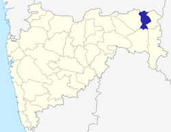 | |
| Geography | ||
| Cities and towns | ||
| Transport | ||
| Lok Sabha constituencies | ||
| Vidhan Sabha constituencies | ||
Places adjacent to Tumsar | ||||||||||
|---|---|---|---|---|---|---|---|---|---|---|
| ||||||||||