Pauni
| Pauni | |
|---|---|
| Town | |
 Pauni Location in Maharashtra, India | |
| Coordinates: 20°47′N 79°38′E / 20.78°N 79.63°ECoordinates: 20°47′N 79°38′E / 20.78°N 79.63°E | |
| Country |
|
| State | Maharashtra |
| District | Bhandara |
| Government | |
| • Type | Municipal Council |
| • Body | Pauni Municipal Council |
| Area | |
| • Total | 9 km2 (3 sq mi) |
| Elevation | 226 m (741 ft) |
| Population (2011) | |
| • Total | 22,821 |
| • Density | 2,500/km2 (6,600/sq mi) |
| Languages | |
| • Official | Marathi |
| Time zone | UTC+5:30 (IST) |
| PIN | 441910 |
| Vehicle registration | MH-36 |
| Nearest Railway Station | Pauni Road |
Pauni is a town and a Municipal Council in Bhandara district in the Indian state of Maharashtra.
Geography
Pauni is located at 20°47′N 79°38′E / 20.78°N 79.63°E.[1] It has an average elevation of 226 metres (741 feet).
Introduction
Pauni (Pauni derived from the name of king "Pavan") is situated on the bank of river Wainganga known as South Ganga. It is a center of market and trade for the surrounding smaller villages and connects the smaller villages to cities like Nagpur, Chandrapur, Bhandara and Gondhia. In ancient times, Pauni was famous for the handloom textile industry. It is also a place of pilgrimage and boasts of many temples, schools a high school and a science college. Pauni also faces extreme weather conditions.
King Pawan ruled this town years ago. On entering the town, one can see a large entrance of a fort. The town is surrounded on three sides by hills and the fourth side by the river. The main language of Pauni is Marathi, which is the regional language of the state of Maharashtra.
Demographics
As of 2001 India census,[2] Pauni had a population of 26250 . Males 51% of the population and females 49%. Pauni has an average literacy rate of 71%, higher than the national average of 59.5%: male literacy is 80%, and female literacy is 63%. In Pauni, 12% of the population is under 6 years of age.It was the ancient Buddhist city. many pilgrims have been found near and in the pauni. Pauni is an ancient town. The remains of historical monuments are scattered all over the town. The town is surrounded by a fort wall. The river Wainganga flows on the Northern side of the town. Number of bathing ghats viz. Diwan Ghat, Ghode Ghat, Vajreshwat Ghat, Hatti Ghat etc. are constructed along the river bank. Some of these ghats are still in good condition. There is renumber of small lakes along the fort wall. It appears that there are remains of what once was the water barrier which served the purpose of defending the town from the invaders.
There are about 150 temples scattered all over the town. Pauni has therefore been described as temple town. The important temples are The Great Goddess Bhangaram Mata Twemple, the Dattatraya temples in Vitthal Gujari, the Nilkanth temple, Panchmukhi Ganesh temple, the Chandakai temple, Murlidhar temple, the Vaijeshwar temple and Ram temple. The entire existing town is located on remains of ancient settlement. Number of Ring walls constructed of bricks or by placing earthen pots over one another can be seen at several places in Pauni. These were used for the purpose of draining the sewer.
There is small earthen mound about 20' high to the South of Pauni Town outside the fort-wall. There is one temple constructed on this mound which is known as the Jagananath temple. This temple appears to be of recent origin. The ancient history department of Nagpur
University has carried out archeological excavation around the Jaganath temple in 1969. These excavations have unearthed the remains of a huge stupa of Buddhist era. These excavations have revealed that original stupa was constructed in pre Ashoka's period and was later enlarged in Sung period.
About 1/2 kilometer to the south of Jagannath temple, one more stupa has been unearthed which is known as Chandakur stupa. Pauni is one of the famous place after Nagpur where Dasara festival is celebrated. Pauni is surrounded by Umred-Karhandla wildlife sanctuary, which is famous for tigers and other wild animals.
Transportation
It is connected to the cities of Bhandara, Nagpur, Chandrapur, Gadchilroli via State Highways. Pauni is not far from NH6, It is Hardly 45 Km from NH6. It Has Nearest Railway Station At Pauni Road at Amgaon(Railway Station) which goes From Nagpur To Nagbhir.
References
- ↑ Falling Rain Genomics, Inc - Pauni
- ↑ "Census of India 2001: Data from the 2001 Census, including cities, villages and towns (Provisional)". Census Commission of India. Archived from the original on 2004-06-16. Retrieved 2008-11-01.
Bhandara district topics | ||
|---|---|---|
| History | 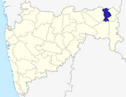 | |
| Geography | ||
| Cities and towns | ||
| Transport | ||
| Lok Sabha constituencies | ||
| Vidhan Sabha constituencies | ||