Troy Grove, Illinois
| Troy Grove | |
|---|---|
| Village | |
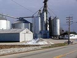 Grain elevator in Troy Grove | |
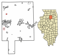 Location of Troy Grove in LaSalle County, Illinois. | |
.svg.png) Location of Illinois in the United States | |
| Coordinates: 41°27′56″N 89°4′52″W / 41.46556°N 89.08111°WCoordinates: 41°27′56″N 89°4′52″W / 41.46556°N 89.08111°W | |
| Country | United States |
| State | Illinois |
| County | LaSalle |
| Township | Troy Grove |
| Area[1] | |
| • Total | 0.69 sq mi (1.78 km2) |
| • Land | 0.69 sq mi (1.78 km2) |
| • Water | 0.00 sq mi (0.00 km2) |
| Elevation | 665 ft (203 m) |
| Population (2010) | |
| • Total | 250 |
| • Estimate (2016)[2] | 242 |
| • Density | 352.26/sq mi (136.04/km2) |
| Time zone | UTC-6 (CST) |
| • Summer (DST) | UTC-5 (CDT) |
| ZIP Code(s) | 61372 |
| Area code(s) | Area codes 815 and 779 |
| FIPS code | 17-76225 |
| Wikimedia Commons | Troy Grove, Illinois |
Troy Grove is a village in LaSalle County, Illinois, United States. The population was 305 at the 2000 census. It is part of the Ottawa–Streator Micropolitan Statistical Area.
Troy Grove is notable as the birthplace of Wild Bill Hickok and Kate Austin. It is home to the Wild Bill Hickok Memorial.
Silica sand, a fine white sand used in making glass, is mined in the vicinity of Troy Grove.
History
A post office called Troy Grove has been in operation since 1837.[3] The community took its name from a nearby grove, which was named for an early settler.[4]
Geography
Troy Grove is located at 41°27′56″N 89°4′52″W / 41.46556°N 89.08111°W (41.465461, -89.081204).[5]
Troy Grove was formerly known as Homer.
According to the 2010 census, Troy Grove has a total area of 0.69 square miles (1.79 km2), all land.[6]
Demographics
| Historical population | |||
|---|---|---|---|
| Census | Pop. | %± | |
| 1880 | 168 | — | |
| 1890 | 283 | 68.5% | |
| 1900 | 316 | 11.7% | |
| 1910 | 289 | −8.5% | |
| 1920 | 261 | −9.7% | |
| 1930 | 259 | −0.8% | |
| 1940 | 233 | −10.0% | |
| 1950 | 258 | 10.7% | |
| 1960 | 271 | 5.0% | |
| 1970 | 281 | 3.7% | |
| 1980 | 297 | 5.7% | |
| 1990 | 259 | −12.8% | |
| 2000 | 305 | 17.8% | |
| 2010 | 250 | −18.0% | |
| Est. 2016 | 242 | [2] | −3.2% |
| U.S. Decennial Census[7] | |||
As of the census[8] of 2000, there were 305 people, 103 households, and 77 families residing in the village. The population density was 444.2 people per square mile (170.7/km²). There were 108 housing units at an average density of 157.3 per square mile (60.4/km²). The racial makeup of the village was 95.41% White, 1.97% Asian, 0.33% Pacific Islander, 1.31% from other races, and 0.98% from two or more races. Hispanic or Latino of any race were 5.57% of the population.
There were 103 households out of which 44.7% had children under the age of 18 living with them, 60.2% were married couples living together, 8.7% had a female householder with no husband present, and 24.3% were non-families. 17.5% of all households were made up of individuals and 4.9% had someone living alone who was 65 years of age or older. The average household size was 2.96 and the average family size was 3.45.
In the village, the population was spread out with 33.1% under the age of 18, 10.5% from 18 to 24, 27.2% from 25 to 44, 20.3% from 45 to 64, and 8.9% who were 65 years of age or older. The median age was 33 years. For every 100 females, there were 86.0 males. For every 100 females age 18 and over, there were 92.5 males.
The median income for a household in the village was $55,682, and the median income for a family was $56,591. Males had a median income of $40,417 versus $23,250 for females. The per capita income for the village was $16,595. About 6.6% of families and 4.5% of the population were below the poverty line, including 5.8% of those under the age of eighteen and none of those sixty five or over.
References
- ↑ "2016 U.S. Gazetteer Files". United States Census Bureau. Retrieved Jun 30, 2017.
- 1 2 "Population and Housing Unit Estimates". Retrieved June 9, 2017.
- ↑ "LaSalle County". Jim Forte Postal History. Retrieved 30 March 2015.
- ↑ Chicago and North Western Railway Company (1908). A History of the Origin of the Place Names Connected with the Chicago & North Western and Chicago, St. Paul, Minneapolis & Omaha Railways. p. 131.
- ↑ "US Gazetteer files: 2010, 2000, and 1990". United States Census Bureau. 2011-02-12. Retrieved 2011-04-23.
- ↑ "G001 - Geographic Identifiers - 2010 Census Summary File 1". United States Census Bureau. Retrieved 2015-12-25.
- ↑ "Census of Population and Housing". Census.gov. Retrieved June 4, 2015.
- ↑ "American FactFinder". United States Census Bureau. Retrieved 2008-01-31.
Municipalities and communities of LaSalle County, Illinois, United States | ||
|---|---|---|
| Cities | ||
| Villages | ||
| Townships |
| |
| CDPs | ||
| Other unincorporated communities |
| |
| Ghost towns |
| |
| Footnotes | ‡This populated place also has portions in an adjacent county or counties | |