Cedar Point, Illinois
| Cedar Point | |
|---|---|
| Village | |
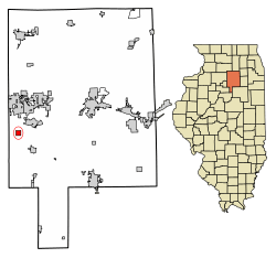 Location of Cedar Point in LaSalle County, Illinois. | |
.svg.png) Location of Illinois in the United States | |
| Coordinates: 41°15′46″N 89°7′35″W / 41.26278°N 89.12639°WCoordinates: 41°15′46″N 89°7′35″W / 41.26278°N 89.12639°W | |
| Country | United States |
| State | Illinois |
| County | LaSalle |
| Township | Eden |
| Area[1] | |
| • Total | 1.02 sq mi (2.64 km2) |
| • Land | 1.02 sq mi (2.64 km2) |
| • Water | 0.00 sq mi (0.00 km2) |
| Elevation | 654 ft (199 m) |
| Population (2010) | |
| • Total | 277 |
| • Estimate (2016)[2] | 268 |
| • Density | 262.49/sq mi (101.35/km2) |
| Time zone | UTC-6 (CST) |
| • Summer (DST) | UTC-5 (CDT) |
| ZIP Code(s) | 61316 |
| Area code(s) | 815 |
| FIPS code | 17-11982 |
| Wikimedia Commons | Cedar Point, Illinois |
Cedar Point is a village in LaSalle County, Illinois, United States. The population was 277 at the 2010 census, up from 262 in 2000. It is part of the Ottawa–Streator Micropolitan Statistical Area. North of town was the Cedar Point Mine, which operated from 1906 to 1924.[3]
Geography
Cedar Point is located at 41°15′46″N 89°07′35″W / 41.262792°N 89.126476°W.[4]
According to the 2010 census, Cedar Point has a total area of 1.02 square miles (2.64 km2), all land.[5]
Demographics
| Historical population | |||
|---|---|---|---|
| Census | Pop. | %± | |
| 1910 | 545 | — | |
| 1920 | 686 | 25.9% | |
| 1930 | 266 | −61.2% | |
| 1940 | 279 | 4.9% | |
| 1950 | 296 | 6.1% | |
| 1960 | 308 | 4.1% | |
| 1970 | 304 | −1.3% | |
| 1980 | 344 | 13.2% | |
| 1990 | 275 | −20.1% | |
| 2000 | 262 | −4.7% | |
| 2010 | 277 | 5.7% | |
| Est. 2016 | 268 | [2] | −3.2% |
| U.S. Decennial Census[6] | |||
As of the census[7] of 2000, there were 262 people, 117 households, and 78 families residing in the village. The population density was 256.3 people per square mile (99.2/km²). There were 126 housing units at an average density of 123.2 per square mile (47.7/km²). The racial makeup of the village was 98.09% White, 1.53% African American, and 0.38% from two or more races. Hispanic or Latino of any race were 0.76% of the population.
There were 117 households out of which 23.1% had children under the age of 18 living with them, 49.6% were married couples living together, 12.0% had a female householder with no husband present, and 32.5% were non-families. 26.5% of all households were made up of individuals and 14.5% had someone living alone who was 65 years of age or older. The average household size was 2.24 and the average family size was 2.61.
In the village, the population was spread out with 18.7% under the age of 18, 9.9% from 18 to 24, 25.6% from 25 to 44, 25.6% from 45 to 64, and 20.2% who were 65 years of age or older. The median age was 40 years. For every 100 females, there were 95.5 males. For every 100 females age 18 and over, there were 95.4 males.
The median income for a household in the village was $41,875, and the median income for a family was $48,750. Males had a median income of $36,250 versus $19,500 for females. The per capita income for the village was $18,988. About 4.0% of families and 3.0% of the population were below the poverty line, including 5.0% of those under the age of eighteen and 3.9% of those sixty five or over.
References
- ↑ "2016 U.S. Gazetteer Files". United States Census Bureau. Retrieved Jun 29, 2017.
- 1 2 "Population and Housing Unit Estimates". Retrieved June 9, 2017.
- ↑ "Archived copy" (PDF). Archived from the original (PDF) on 2010-06-14. Retrieved 2011-09-04.
- ↑ "US Gazetteer files: 2010, 2000, and 1990". United States Census Bureau. 2011-02-12. Retrieved 2011-04-23.
- ↑ "G001 - Geographic Identifiers - 2010 Census Summary File 1". United States Census Bureau. Retrieved 2015-08-02.
- ↑ "Census of Population and Housing". Census.gov. Archived from the original on May 12, 2015. Retrieved June 4, 2015.
- ↑ "American FactFinder". United States Census Bureau. Archived from the original on 2013-09-11. Retrieved 2008-01-31.
Municipalities and communities of LaSalle County, Illinois, United States | ||
|---|---|---|
| Cities | ||
| Villages | ||
| Townships |
| |
| CDPs | ||
| Other unincorporated communities |
| |
| Ghost towns |
| |
| Footnotes | ‡This populated place also has portions in an adjacent county or counties | |