Transportation in Moscow
The Moscow transportation network uses buses, trams, Metro, motorways, trains and planes to provide connectivity between Moscow's districts and beyond.
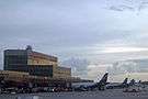
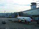
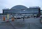
Air

There are five primary commercial airports serving Moscow: Sheremetyevo International Airport, Domodedovo International Airport, Bykovo Airport, Zhukovsky International Airport and Vnukovo International Airport. Sheremetyevo International Airport is the most common entry point for foreign passengers, handling sixty percent of all international flights.[1] Domodedovo International Airport is the leading airport in Russia in terms of passenger throughput, and is the primary gateway to long-haul domestic and CIS destinations and its international traffic rivals Sheremetyevo's. The three other airports particularly offer flights within Russia and to and from states from the former Soviet Union.[2] Moscow's airports vary in distances from MKAD beltway: Bykovo is the farthest, at 35 kilometres (21 mi); Domodedovo is next at 22 kilometres (13.7 mi); Vnukovo is 11 kilometres (6.8 mi) and Sheremetyevo is 10 kilometres (6.25 mi).
There are several smaller airports near Moscow, such as Myachkovo Airport, intended for private aircraft, helicopters and charters.[3]
| Main international airports serving Greater Moscow |
|---|
Water
Moscow has two passenger terminals, (South River Terminal and North River Terminal or Rechnoy vokzal), on the river and regular ship routes and cruises along Moskva and Oka rivers, which are used mostly for entertainment. The North River Terminal, built in 1937, is the main hub for long-range river routes. There are three freight ports serving Moscow.
Land
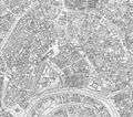
Transport rings in Moscow
Transport rings in Moscow including rings in Moscow Oblast that are centered on Moscow
| Length | Name | Type |
|---|---|---|
| Boulevard Ring - Bulvarnoye Koltso (not a full ring) | Road | |
| 17 km | Garden Ring - Sadovoye Koltso ("B") | Road |
| 19 km | Koltsevaya Line (Line 5) | Light rail |
| 35 km | Third Ring Road - Third Transport Ring - Tretye Transportnoye Koltso (TTK) | Road |
| 54 km | Little Ring of the Moscow Railway, re-opened as Moscow Central Ring (MCC) - Line 14 | Railway |
| 58 km | Bolshaya Koltsevaya line - Line 11 | Light rail |
| 74 km | Fourth Ring Road - Fourth Transport Ring | Road |
| 109 km | Moscow Automobile Ring Road - Moskovskaya Koltsevaya Avtomobilnaya Doroga (MKAD) | Road |
| 333 km | A107 "Moscow Small Ring" (MMK) | Road |
| 564 km | A108 "Moscow Big Ring" (MBK) | Road |
| 584 km | Greater Ring of the Moscow Railway - Bolshoye koltso Moskovskoy Zhelesnoy dorogi (BMO) | Railway |
 17 km
17 km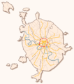 19 km
19 km 35 km
35 km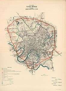 km
km.jpg) 54 km
54 km 58 km
58 km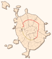 74 km
74 km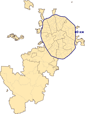 109 km
 333 km, 564 km
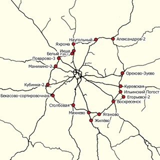 584 km
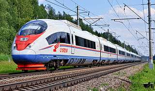
Railway
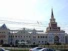
Moscow has several train stations serving the city. Moscow's nine rail terminals (or vokzals) are:
- Belorussky Rail Terminal
- Kazansky Rail Terminal
- Kiyevsky Rail Terminal
- Kursky Rail Terminal
- Leningradsky Rail Terminal
- Paveletsky Rail Terminal
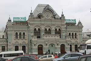
- Rizhsky Rail Terminal
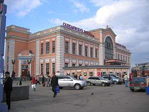
- Savyolovsky Rail Terminal
- Yaroslavsky Rail Terminal
They are located close to the city center, but each handles trains from different parts of Europe and Asia.[4] There are smaller railway stations in Moscow. As train tickets are relatively cheap, they are the mode of preference for travelling Russians, especially when departing to Saint Petersburg, Russia's second-largest city. Moscow is the western terminus of the Trans-Siberian Railway, which traverses nearly 9,300 kilometres (5,800 mi) of Russian territory to Vladivostok on the Pacific coast.
Suburbs and satellite cities are connected by commuter elektrichka (electric rail) network. Elektrichkas depart from each of these terminals to the nearby (up to 140 kilometres (87 mi)) large railway stations.
The Moscow Little Ring Railway is now integrated in the Moscow Metro System.
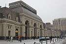
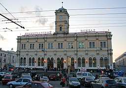
| Mainline intercity and suburban rail terminals of Moscow |
|---|


Metro
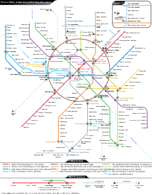
Local transport includes the Moscow Metro, a metro system famous for its art, murals, mosaics, and ornate chandeliers. When it opened in 1935, the system had two lines. Today, the Moscow Metro contains twelve lines, mostly underground with a total of 196 stations. The Metro is one of the deepest subway systems in the world; for instance the Park Pobedy station, completed in 2003, at 84 metres (276 ft) underground, has the longest escalators in Europe. The Moscow Metro is one of the world's busiest metro systems, serving more than nine million passengers daily.[5] Facing serious transportation problems, Moscow has plans for expanding its Metro.
Bus and trolleybus
As Metro stations outside the city center are far apart in comparison to other cities, up to 4 kilometres (2.5 mi), a bus network radiates from each station to the residential zones. Moscow has a bus terminal for long-range and intercity passenger buses (Central Bus Terminal) with daily turnover of about 25 thousand passengers serving about 40% of long-range bus routes in Moscow.[6]
Every major street in the city is served by at least one bus route. Many of these routes are doubled by a trolleybus routes and have trolley wires over them.
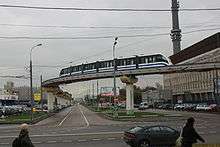
Monorail
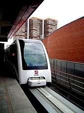
There is a short monorail line, operated by the Moscow Metro company. The line connects Timiryazevskaya metro station and Sergeya Eisensteina street, passing close to VVTs. The line opened in 2004.
Tram
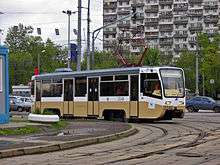
Moscow has an extensive tram system, which opened in 1899. The newest line was built in 1984. Its daily usage by Muscovites is low, approximately 5% of trips, because many vital connections in the network have been withdrawn. Trams still remain important in some districts as feeders to Metro stations. The trams provide important cross links between metro lines, for example between University station of Sokolnicheskaya Line (#1 red line) and Profsoyuznaya station of Kaluzhsko-Rizhskaya Line (#6 orange line) or Voykovskaya-Schukinskaya.
There are three tram networks in the city:
- Krasnopresnenskoye depot network with the westernmost point at Strogino (depot location) and the easternmost point near platform Dmitrovskaya. This network became separated in 1973, but until 1997 it could have been reconnected by about one kilometer of track and three switches. The network has the highest usage in Moscow and no weak points based on turnover except to-depot lane (passengers serviced by bus) and tram ring at Dmitrovskaya (because now is neither normal transfer point nor repair terminal).
- Apakov depot services south-western part from Varshavsky lane-Simferopolsky boulevard in the east to Metro University in the west and Boulevard lane at the center. This network is connected only by 4-way Dubininskaya and Kogevnicheskaaya street. A second connection by Vostochnaya (Eastern) street was withdrawn in 1987 due to fire at Dinamo plant and has not been recovered, remains lost (Avtozavodsky bridge) at 1992. The network may be serviced anyway by another depot (now route 35, 38).
- Main three depot networks with railway gate and tram-repair plant.
Taxi
In Russia and Moscow, the difference between hailing a cab and simply hitchhiking is blurry because a tradition is for drivers to offer rides to strangers for a fee. A cab can usually be found in a matter of minutes by holding out the hand. Commercial taxi services are available. Route taxis are in widespread use. Modern internet based services using apps like Yandex Taxi now easily connect passengers to Taxis. Prices are modest, currently typically 500 Roubles from central Moscow to the outer suburban areas.
Cars
There are over 2.6 million cars in the city on a daily basis.[7] Recent years have seen the growth in the number of cars, which have caused traffic jams and the lack of parking space, to become major problems.
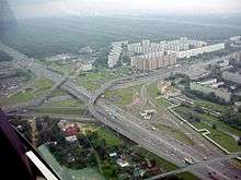
The MKAD, along with the Third Transport Ring and the future Fourth Transport Ring, is one of only three freeways that run within Moscow city limits. However, there are several other roadway systems that form concentric circles around the city.
Bicycle
Since June 2013, a bicycle-sharing system named Velobike is in operation.
Moscow Public Transportation Statistics
The average amount of time people spend commuting with public transit in Moscow, for example to and from work, on a weekday is 67 min. 16.7% of public transit riders, ride for more than 2 hours every day. The average amount of time people wait at a stop or station for public transit is 11 min, while 15.3% of riders wait for over 20 minutes on average every day. The average distance people usually ride in a single trip with public transit is 9 km, while 23% travel for over 12 km in a single direction. [8]
References
- ↑ "Moscow Airports". Go-Russia. 7 October 2007. Archived from the original on 11 October 2007. Retrieved 7 October 2007.
- ↑ "Getting to Russia: Arriving by Plane". The Moscow Times. Archived from the original on 28 April 2006. Retrieved 3 July 2006.
- ↑ (in Russian) Airport Myachkovo changed the owners
- ↑ "Getting to Russia: Arriving by Train". The Moscow Times. Archived from the original on 28 May 2006. Retrieved 3 July 2006.
- ↑ Московский метрополитен (in Russian). Archived from the original on 14 July 2006. Retrieved 4 July 2006.
- ↑ See also: (in Russian) Realty news. Retrieved on 22 July 2006.
- ↑ СТОЛИЦА РОССИЙСКОЙ ФЕДЕРАЦИИ В ЗЕРКАЛЕ ЦИФР, ФАКТОВ И СОБЫТИЙ (in Russian). Moscow government. Retrieved 28 April 2010.
- ↑ "Moscow Public Transportation Statistics". Global Public Transit Index by Moovit. Retrieved June 19, 2017.
