Transhimalaya
| Transhimalaya (Gangdise – Nyenchen Tanglha range, Hedin Mountains) | |
|---|---|
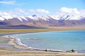 Part of the Nyenchen Tanglha range in the Transhimalayas | |
| Highest point | |
| Peak | Mount Nyenchen Tanglha |
| Elevation | 7,162 m (23,497 ft) |
| Dimensions | |
| Length | 160 km (99 mi) |
| Geography | |
| State | Tibet |
| Range coordinates | 30°23′00″N 90°34′31″E / 30.383427°N 90.5752890°ECoordinates: 30°23′00″N 90°34′31″E / 30.383427°N 90.5752890°E |
| Parent range | Alpine orogeny, Tibetan Plateau (perimeter range) |
The Transhimalaya (also spelled Trans-Himalaya) or "Gangdise – Nyenchen Tanglha range", is a 1600-kilometre-long mountain range in China, extending in a west–east direction parallel to the main Himalayan range. Located north of Yarlung Tsangpo river on the southern edge of the Tibetan Plateau, the Transhimalaya is composed of the Gangdise range to the west and the Nyenchen Tanglha range to the east.
The Trans-Himalaya was described by the Columbia Lippincott Gazetteer in 1952 as an "ill-defined mountain area" with "no marked crest line or central alignment and no division by rivers." On more-modern maps the Kailas Range (Gangdise or Kang-to-sé Shan) in the west is shown as distinct from the Nyenchen Tanglha range in the east.[1]
References
- ↑ Allen 2013, p. 142.
Sources
- Allen, Charles (2013-01-17). A Mountain In Tibet: The Search for Mount Kailas and the Sources of the Great Rivers of Asia. Little, Brown Book Group. ISBN 978-1-4055-2497-1. Retrieved 2015-02-07.
This article is issued from
Wikipedia.
The text is licensed under Creative Commons - Attribution - Sharealike.
Additional terms may apply for the media files.