Tonopah Airport
| Tonopah Airport | |||||||||||||||
|---|---|---|---|---|---|---|---|---|---|---|---|---|---|---|---|
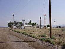
 USGS aerial image, 1999 | |||||||||||||||
| Summary | |||||||||||||||
| Airport type | Public | ||||||||||||||
| Owner | Nye County | ||||||||||||||
| Serves | Tonopah, Nevada | ||||||||||||||
| Elevation AMSL | 5,430 ft / 1,655 m | ||||||||||||||
| Coordinates | 38°03′37″N 117°05′12″W / 38.06028°N 117.08667°W | ||||||||||||||
| Runways | |||||||||||||||
| |||||||||||||||
| Statistics (2009) | |||||||||||||||
| |||||||||||||||
Tonopah Airport (IATA: TPH, ICAO: KTPH, FAA LID: TPH) is a county-owned, public-use airport located seven nautical miles (13 km) east of the central business district of Tonopah, in Nye County, Nevada, United States.[1]
Tonopah Airport
Facilities and aircraft
Tonopah Airport covers an area of 3,820 acres (1,550 ha) at an elevation of 5,430 feet (1,655 m) above mean sea level. It has two asphalt paved runways: 15/33 is 7,161 by 80 feet (2,183 x 24 m) and 11/29 is 6,196 by 50 feet (1,889 x 15 m).[1]
For the 12-month period ending November 30, 2009, the airport had 12,727 aircraft operations, an average of 34 per day: 74% general aviation, 25% air taxi, and 2% military. At that time six aircraft were based here: 5 single-engine and 1 helicopter.[1]
References
External links
| Wikimedia Commons has media related to Tonopah Airport. |
- "Diagram of Tonopah Airport (TPH)" (PDF). Archived from the original (PDF) on 2016-03-04. from Nevada DOT
- FAA Airport Diagram (PDF), effective October 11, 2018
- FAA Terminal Procedures for TPH, effective October 11, 2018
- Resources for this airport:
- FAA airport information for TPH
- AirNav airport information for KTPH
- ASN accident history for TPH
- FlightAware airport information and live flight tracker
- NOAA/NWS latest weather observations
- SkyVector aeronautical chart, Terminal Procedures
This article is issued from
Wikipedia.
The text is licensed under Creative Commons - Attribution - Sharealike.
Additional terms may apply for the media files.