Tobe, Ehime
| Tobe 砥部町 | |||
|---|---|---|---|
| Town | |||
| |||
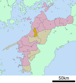 Location of Tobe in Ehime Prefecture | |||
 Tobe Location in Japan | |||
| Coordinates: 33°45′N 132°48′E / 33.750°N 132.800°ECoordinates: 33°45′N 132°48′E / 33.750°N 132.800°E | |||
| Country | Japan | ||
| Region | Shikoku | ||
| Prefecture | Ehime Prefecture | ||
| District | Iyo | ||
| Area | |||
| • Total | 101.57 km2 (39.22 sq mi) | ||
| Population (May 1, 2017) | |||
| • Total | 21,471 | ||
| • Density | 210/km2 (550/sq mi) | ||
| Symbols | |||
| • Tree | Sawtooth Oak (櫟 Kunugi) | ||
| • Flower | Ume (梅) | ||
| Time zone | UTC+9 (JST) | ||
| City hall address |
1392 Miyauchi, Tobe-chō, Iyo-gun, Ehime-ken 791-2195 | ||
| Website |
www | ||


Tobe (砥部町 Tobe-chō) is a town located in Iyo District, Ehime Prefecture, Japan.
As of January 1, 2005, the village of Hirota, also from Iyo District, was merged into Tobe.
As of May 1, 2017, the town has an estimated population of 21,471 and a density of 210 persons per km².[1] The total area is 101.57 km².
Geography
Surrounding municipalities
Education
Ehime Prefectural University of Health Science is located in the town. Furthermore, Tobe contains a high school, a junior high school and three elementary schools.
Transportation
Highways
- Matsuyama Expressway
- Japan national routes
References
- ↑ "Official website of Tobe Town" (in Japanese). Japan: Tobe Town. Retrieved 26 May 2017.
External links

- Tobe official website (in Japanese)
| Core city | ||
|---|---|---|
| Cities | ||
| Districts | ||
This article is issued from
Wikipedia.
The text is licensed under Creative Commons - Attribution - Sharealike.
Additional terms may apply for the media files.