Tippecanoe, Ohio
| Tippecanoe, Ohio | |
|---|---|
| Census-designated place | |
 Location of Tippecanoe, Ohio | |
| Coordinates: 40°16′14″N 81°17′12″W / 40.27056°N 81.28667°WCoordinates: 40°16′14″N 81°17′12″W / 40.27056°N 81.28667°W | |
| Country | United States |
| State | Ohio |
| County | Harrison |
| Township | Washington |
| Area[1] | |
| • Total | 0.54 sq mi (1.39 km2) |
| • Land | 0.54 sq mi (1.39 km2) |
| • Water | 0 sq mi (0 km2) |
| Elevation[2] | 880 ft (270 m) |
| Population (2010)[1] | |
| • Total | 121 |
| • Density | 225/sq mi (87.0/km2) |
| Time zone | UTC-5 (Eastern (EST)) |
| • Summer (DST) | UTC-4 (EDT) |
| ZIP code | 44699 |
| Area code(s) | 740 |
| FIPS code | 39-76890[1] |
| GNIS feature ID | 1061693[2] |
Tippecanoe is an unincorporated community and census-designated place (CDP) in central Washington Township, Harrison County, Ohio, United States. It is located along State Route 800 in the valley of Stillwater Creek, a north-flowing tributary of the Tuscarawas River. Although it is unincorporated, it had a post office until 2011 with the ZIP code of 44699.[3] The population was 121 at the 2010 census.[1]
Geography
Tippecanoe is in southwestern Harrison County, 12 miles (19 km) south of Uhrichsville and 5 miles (8 km) north of Freeport via State Route 800. Cadiz, the Harrison county seat, is 20 miles (32 km) to the east via county roads. Tippecanoe is less than one mile west of Clendening Dam, the outlet of Clendening Lake.
According to the United States Census Bureau, the CDP has a total area of 0.54 square miles (1.39 km2), all land.[1]
History
Tippecanoe was platted in 1840.[4] The community derives its name from the campaign song "Tippecanoe and Tyler Too".[5] A post office was established at Tippecanoe in 1841,[6] and remained in operation until it was discontinued in 2011.[7]
References
- 1 2 3 4 5 "Geographic Identifiers: 2010 Census Summary File 1 (G001): Tippecanoe CDP, Ohio". American Factfinder. U.S. Census Bureau. Retrieved December 29, 2017.
- 1 2 U.S. Geological Survey Geographic Names Information System: Tippecanoe, Ohio
- ↑ Zip Code Lookup
- ↑ Hanna, Charles Augustus (1900). Historical Collections of Harrison County, in the State of Ohio. p. 115.
- ↑ Overman, William Daniel (1958). Ohio Town Names. Akron, OH: Atlantic Press. p. 133.
- ↑ "Harrison County". Jim Forte Postal History. Retrieved 11 December 2015.
- ↑ "Postmaster Finder". United States Postal Service. Retrieved 11 December 2015.
Municipalities and communities of Harrison County, Ohio, United States | ||
|---|---|---|
| Villages | 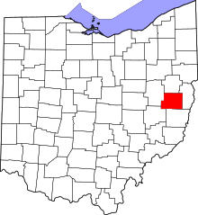 | |
| Townships | ||
| CDP | ||
| Unincorporated communities | ||
| Ghost towns | ||
| Footnotes | ‡This populated place also has portions in an adjacent county or counties | |