Tingha, New South Wales
| Tingha New South Wales | |
|---|---|
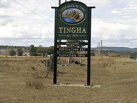 Tingha entry sign | |
|
Tingha | |
| Coordinates | 29°57′S 151°13′E / 29.950°S 151.217°ECoordinates: 29°57′S 151°13′E / 29.950°S 151.217°E |
| Population | 887 (2006 census)[1] |
| Established | 1885 |
| Postcode(s) | 2369 |
| Elevation | 780 m (2,559 ft) |
| Location | 30 km (19 mi) from Inverell |
| LGA(s) | Armidale Regional Council |
| County | Hardinge |
| Federal Division(s) | New England |
.JPG)
.JPG)
Tingha is a small town on the Northern Tablelands, New South Wales, Australia in Armidale Regional Council. It is 30 kilometres (19 mi) south of Inverell and 629 kilometres (391 mi) north-north-east of Sydney. Tingha is an Aboriginal word for "flat or level".[2]
History
Before non indigenous settlement the area now known as Tingha was mainly lived upon by people from the Nucoorilma group, which is an associated group of the Murri Aboriginal people. Many of their descendants still live in the surrounding area.
Tingha was first settled in 1841 by Sydney Hudson Darby and became a mining town after tin was discovered there in the 1870s.[3] Within a year Australia’s first commercial tin mines were operating at a private settlement known as Armidale Crossing. Over 6,000 people arrived and more than 25% of the miners were Chinese. The Wing Hing Long Museum is a reminder of that heritage. Armidale Crossing Post Office opened on 1 September 1872 and was renamed Tingha the next month.[4]
The village was proclaimed a town in 1885. Initially there were enough readily accessible surface deposits to make a good living without using machinery as Chinese people did. The first school was established by the Sisters of St. Joseph in 1890. In the 1890s drought came to the district and the easily obtained deposits of tin were exhausted leading to a loss in population.[5]
By the early 1900s the mining boom was over and Tingha's population had dwindled to just a few hundred people. Shortly after this, large companies moved into the area to mine the less accessible tin.
Heritage listings
Tingha has a number of heritage-listed sites, including:
- 10 Ruby Street: Wing Hing Long & Co. Store[6]
Today
The main industry nowadays is agriculture with some fossicking in the area. Tin dredging and mining has continued on a scale that varies according to international price fluctuations.
Tingha has a hospital, pre-school, primary school, caravan park, sports and recreation club, a first aid post, hotels plus other shops and services to supply daily needs. Tingha Tigers rugby league club have a large following and have produced several National Rugby League players. Tingha's "swimming hole" is a large man made pool which was once a mining excavation.[7] One of the main attractions around Tingha is "Green Valley Farm" Entertainment Park.In 2018, the town's residents voted for the town to become a part of Inverell Shire Council area.
Notable people
- Nathan Blacklock former NRL Australia national rugby league team, St George Illawarra Dragons, Hull F.C. and New South Wales Waratahs player.
- Preston Campbell former Gold Coast Titans, Cronulla Sharks, Penrith Panthers and Gold Coast Chargers player.
- Bevan French current Parramatta Eels professional rugby league player who played junior rugby league for the Tingha Tigers.
References
- ↑ Australian Bureau of Statistics (25 October 2007). "Tingha (State Suburb)". 2006 Census QuickStats. Retrieved July 26, 2008.
- ↑ "Tingha". Geographical Names Register (GNR) of NSW. Geographical Names Board of New South Wales. Retrieved 4 August 2013.
- ↑ "Armidale, Guyra, Uralla, Walcha", June 2007
- ↑ Premier Postal History. "Post Office List". Premier Postal Auctions. Archived from the original on 19 August 2008. Retrieved 26 May 2011.
- ↑ Readers Digest Guide to Australian Places, Readers Digest, Sydney
- ↑ "Wing Hing Long & Co. Store, New South Wales State Heritage Register (NSW SHR) Number H01307". New South Wales State Heritage Register. Office of Environment and Heritage. Retrieved 18 May 2018.
- ↑ New England Holiday, Express Print, Armidale, nd