Tillsonburg
| Tillsonburg | |
|---|---|
| Town (lower-tier) | |
| Town of Tillsonburg | |
 | |
| Motto(s): Connected. Enriched. Inspired. | |
 Tillsonburg | |
| Coordinates: 42°52′00″N 80°44′00″W / 42.86667°N 80.73333°WCoordinates: 42°52′00″N 80°44′00″W / 42.86667°N 80.73333°W | |
| Country | Canada |
| Province | Ontario |
| County | Oxford |
| Settled | 1825 (as village) |
| Incorporated | 1872 (as town) |
| Government | |
| • Governing Body | Tillsonburg Town Council |
| • Town Mayor | Stephen Molnar |
| • Deputy Mayor | Dave Beres |
| • Councillors |
List of councillors
|
| Area[1] | |
| • Land | 22.33 km2 (8.62 sq mi) |
| Elevation | 270 m (890 ft) |
| Population (2016)[1] | |
| • Total | 15,872 |
| • Density | 710.8/km2 (1,841/sq mi) |
| • Demonym | Tillsonburger |
| Time zone | UTC-5 (EST) |
| • Summer (DST) | UTC-4 (EDT) |
| Forward sortation area | N4G |
| Area code(s) | 519 and 226 |
| Website | www.tillsonburg.ca |
Tillsonburg is a town in Oxford County, Ontario, Canada with a population of 15,872[1] located about 50 kilometres southeast of London, on Highway 3 at the junction of Highway 19 the closest route to Highway 401 at Ingersoll.
History
The area was settled in 1825 by George Tillson and other immigrants from Enfield, Massachusetts. A forge and sawmill were erected and roads built which led to the establishment of this small community, originally called Dereham Forge. The settlement was on the Big Otter Creek.
In 1836 the village was renamed Tillsonburg in honour of its founder. It was also in this year that the main street, Broadway, was laid out to its full 100-foot (30 m) width. Because the village was predominantly a logging and wood product centre, the street was built to accommodate the turning of three-team logging wagons. This width is now unique to Ontario and has become a benefit toward handling the pressures of modern-day traffic by providing angled parking. The extension of Broadway north was called Plank Line and is now known as Highway 19.
The mid-19th century proved to be the first step in the industrialization of this municipality. A water system was devised to not only supply pure water for domestic use, but also to provide water power to such industries as a sawmill, planing mill, grist mill, spinning mill, pottery and a tannery. Many of these new establishments were either owned, started, or financed by George Tillson.
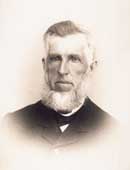
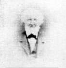
In 1872 the village was incorporated as the Town of Tillsonburg, with Edwin Delevan Tillson elected as its first mayor. The Town of Tillsonburg reached a population of 2,000 in 1885, experienced its first church dedication, and had its first telephone installation established. Electric power was first used in 1912 and automobiles began to appear on the market.
In 1915, a public library was built with funds provided by the Carnegie Foundation, and the town's Memorial Hospital opened in 1925.
In the 1920s, major enterprises included milk production, manufacture of shoes, tractors, textiles and an increased production of tobacco. The Tillsonburg Livingstons Basketball Team (representative of Tillsonburg's largest industry) won the Canadian Championships in 1952 and represented Canada in the Olympics at Helsinki, Finland. CKOT Radio began broadcasting operations in 1955 and the Ontario Flue-Cured Tobacco Marketing Board opened its new auction exchange three years later.
Government
Tillsonburg is one of eight municipalities that make up the County of Oxford. The mayor also represents the town as a County Councillor. The county administers social programs, ambulance and paramedic services, planning, water and wastewater services, garbage and landfill operations and the County road system.
Tillsonburg is governed by an elected mayor, deputy mayor and five councillors. Council meets on the 2nd and 4th Mondays of each month in the Council Chambers in the Corporate Municipal Office. They oversee staff and set policy for the various operations and services provided by the town.
The town also owns and operates:
- Tillsonburg Municipal Airport
- Lake Lisgar Water Park
- Tillsonburg Public Library
Healthcare
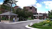
The town has one hospital accredited through the Ontario Ministry of Health. Tillsonburg and District Memorial Hospital is in the downtown area on Rolph Street. The TDMH serves the town and region.
A major fundraising campaign was undertaken to fund the equipment for a dialysis unit at Tillsonburg District Memorial Hospital. This became operational during 2006.
The home support programs of the Multi-Service Centre (personal support & homemaking, assisted living, meals on wheels, transportation, foot & hand care, Home at Last) are accredited by Accreditation Canada.
Development
In the Town's Centennial Year (1972), the new $1,000,000 Community Recreation Complex was opened by the Governor-General of Canada. The Tillsonburg Museum was also opened in the old community centre on the shores of Lake Lisgar. A new 8,000-square-foot (740 m2) library was completed in 1975, and a second indoor skating rink was built in 1977, funded completely by donations from industry, commerce, service clubs, citizens and the Wintario lottery. In 1979, the hospital built a $7,000,000 addition for offices, improved x-ray and emergency departments, and an expanded Intensive Care Unit. A fire hall was constructed in 1979, replacing the old building which was demolished to make way for a downtown mall.
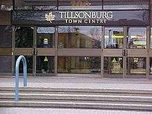
The controversial Tillsonburg Town Centre Mall opened in 1980, where the former Town Hall once stood. The mall, a joint effort of the town and Trottier Investments, was built primarily to meet competition from out-of-town malls and keep more of the shopping dollar in town.
In 1983, two important buildings - Annandale House (built by the founding Tillson family) and the Hale Street railway station became public buildings. The former would be restored as a house museum, while the latter would become The Station Arts Centre.
A major residential development geared for seniors – Hickory Hills – was announced in 1985. The development significantly added to the town's population and increased the pool of volunteers for local non-profit agencies.
In 1991, a food bank was established for the community's needy and continues to be operated on a volunteer basis.
Throughout the early 1990s, volunteers were also busy on the Lake Lisgar Renaissance Project, which sought to revitalize the lake, and make the park around the lake more attractive with the construction of a gazebo, water fountain and walkways into the lake.
In that period two major entertainment outlets closed: the Skylark Drive-In and the Strand movie theatre, victims of the video store arrival. The original angled marquee architecture of the Strand Theatre is still intact but the building is again unoccupied after brief stints as businesses. To the relief of many, big screen movies came back in Tillsonburg in 1996 with the opening of Broadway Cinemas.
In 1994, the downtown area was significantly enhanced with the construction of the Rotary Club Clock Tower, which incorporated a clock from the town's former Post Office, and a bell from the demolished Town Hall. Soon, it became a community tradition (sponsored by the Rotary Club) for local residents to gather at the Clock Tower to ring in the New Year with fireworks, hot apple cider and the dropping of a ball.
Further development of residential senior's focused development began in 2001 with the Baldwin Place subdivision located on the western periphery of the town. This development which is in Phase 8 will have approximately 300 homes when completed.
The Tillsonburg Community Centre was refurbished in 2004 with renovations and enlargement of the main ice surface to NHL size. The project's scope of work included keeping the whale-back roof as a key architectural feature as well as to increase seating and provide for new recreation and health club facilities.
Residential development includes the re-urbanization of the former railway lands on Bridge Street East which is the site of Tillson Landing condominium, the first such highrise construction in more than a decade. Tillson Landing was completed in January 2006.
Another major subdivision containing nearly 400 homes, The Oaks, is under construction. This subdivision is in the south-west area of town on the east side of Quarterline Road between Concession and Baldwin Streets. Additional new subdivision development is concentrated in the west quadrant of town including Park Place, Southridge Heights (Morning Glory), and Brookside Phase 3.
Industry and economy
Tillsonburg serves a regional tri-county area of 225,000 people at the convergence of Oxford, Elgin and Norfolk counties. The industrial base has become quite diverse during the decline of the once prominent tobacco industry. The area is home to several branch plants of major US-based automotive suppliers including Autoneum Canada Ltd, Guardian Industries, THK-TRW and Adient. There are many service-related industries including Verspeeten Transport, Marwood Metal Fabrication Ltd., Inovata Foods, E & E McLaughlin Ltd., J/E Bearing Ltd., Fleetwood Metal Products, and MIL-SIM-FX International Inc.
The town has a very active and developing downtown core area which includes the Tillsonburg Town Centre mall, built in 1980 and big box stores including Canadian Tire, Shopper's Drug Mart and Staples-Business Depot. Newly expanded The Source store and Mark's Work Wearhouse are in the Tillsonburg Town Centre Mall.
All of the major Canadian chartered banks have branches in the town and there is also a credit union.
The town is served by three grocery stores: Sobeys, Zehrs and Metro.
Tillsonburg is served by three radio stations; the New Country 107.3 (107.3 CJDL FM), Country 1510 (1510 CKOT AM), Easy 101 (101.3 CKOT FM) and two newspapers: The Tillsonburg News and The Tillsonburg Independent.
The town has been positively impacted by the CAMI plant in Ingersoll, 22 kilometres north of the town, which opened in 1986. The CAMI plant, owned by General Motors of Detroit, Michigan, produces the Chevrolet Equinox and GMC Terrain CUVs.
The announcement of a new Toyota plant in Woodstock, 30 km northeast of Tillsonburg, will have a similarly positive impact on the development of Tillsonburg. In preparation for the increased traffic demands in the County of Oxford, Highway 19 has been upgraded and completely rebuilt north of the town to Highway 401.
The area also has a strong agricultural community with cash crops, hog farming, milk production, tobacco, ginseng and various tertiary crops (including watermelons).
The town has recently become a hub for regional operations of the Ontario Provincial Police including Oxford County Division Headquarters and also the Southwestern Ontario Forensics laboratory which opened in April 2008.
The town is the third fastest growing community in Oxford County, and ranks as one of the top places to live in Canada.
Tourism
In January 2006 the National Post listed Tillsonburg as number 75 on the top 100 places to visit in Canada.[2] Annandale House was designated a Canadian National Historic Site in 1997.[3]
Tillsonburg is home to three barn quilts. One is on the north end of town on the side of a furniture store, shaped as a barn. Another one is on the grounds of Station Arts in front of the caboose and the third quilt is on the original Pea & Barley Mill, built in 1878 by E.D. Tillson, son of the town's founder and opened in 2009 as the Mill Tales Inn beside the Otter Creek featuring a restaurant and inn. These barn quilts make up part of the Barn Quilt Trail in Southwest Ontario .
Another attraction is the Station Arts Centre, a multi-use facility which was created from two historic train stations that were joined together by a central gallery. It has been home to artistic, cultural and technical groups since its founding in 1983. It is also home to the Saturday morning Tillsonburg Farmers' Market which operates from April to October.
A number of organizations across Tillsonburg collaborate in putting together events such as Turtlefest, the Week of Remembrance and the Tillsonburg Country Christmas Festival.
Camping is available north of town at Casey's Park on Highway #19 north of Mount Elgin, which is the home of weekly Country Music Jamborees between Victoria Day and Labour Day, where audience members are encouraged to participate on stage.
Lake Lisgar, a small lake in the centre of town, has been rehabilitated and is home for the Tillsonburg Rowing Club and the Lake Lisgar Water Park.
Education
Elementary and secondary schools
Tillsonburg elementary and secondary schools are under the control of two school boards, the Thames Valley District School Board (TVDSB) and the London District Catholic School Board (LDCSB).
- Annandale Public School
- Glendale High School
- Monsignor J.H. O'Neill Catholic School
- Rolph Street Public School (closed)
- South Ridge Public School
- St. Joseph's Catholic School
- Maple Lane Public School (closed as of 2014)
- Westfield Public School
Special service schools
- Adult Basic Literacy Program: A Multi-Service Centre program, in the Livingston Centre, established: 1987. Literacy instruction is provided to any adults free of charge. Students are encouraged to purchase their books.
- Tillson Avenue Education Centre: Established: 1995. Adult Day School offering credit courses, independent learning courses, basic literacy, English as a second language (ESL) and driver education.
Demographics
| Census | Population |
|---|---|
| 1871 | 1,700 |
| 1881 | 1,939 |
| 1891 | 2,163 |
| 1901 | 2,241 |
| 1911 | 2,758 |
| 1921 | 2,974 |
| 1931 | 3,385 |
| 1941 | 4,002 |
| 1951 | 5,330 |
| 1961 | 6,600 |
| 1971 | 6,608 |
| 1981 | 10,487 |
| 1991 | 12,019 |
| 2001 | 14,052 |
| 2006 | 14,822 |
| 2011 | 15,301 |
| 2016 | 15,872 |
All statistics are based on the 2006 census by Statistics Canada.[4]
Age
| Tillsonburg | Oxford County | |||||
|---|---|---|---|---|---|---|
| Age | Total | Male | Female | Total | Male | Female |
| Total - All Persons | 14,820 | 6,995 | 7,830 | 102,755 | 50,460 | 52,295 |
| 0 - 4 | 765 | 380 | 385 | 5,945 | 3,075 | 2,870 |
| 5 - 9 | 750 | 395 | 355 | 6,510 | 3,305 | 3,210 |
| 10 - 14 | 880 | 435 | 445 | 7,390 | 3,805 | 3,585 |
| 15 - 19 | 870 | 435 | 430 | 7,275 | 3,685 | 3,590 |
| 20 - 24 | 860 | 445 | 415 | 6,320 | 3,235 | 3,085 |
| 25 - 29 | 825 | 395 | 430 | 5,500 | 2,755 | 2,740 |
| 30 - 34 | 785 | 390 | 400 | 6,045 | 3,035 | 3,005 |
| 35 - 39 | 875 | 440 | 435 | 6,645 | 3,300 | 3,345 |
| 40 - 44 | 1,020 | 485 | 540 | 8,395 | 4,120 | 4,275 |
| 45 - 49 | 1,070 | 490 | 585 | 8,105 | 3,970 | 4,140 |
| 50 - 54 | 950 | 445 | 510 | 7,210 | 3,625 | 3,585 |
| 55 - 59 | 890 | 425 | 465 | 6,425 | 3,195 | 3,225 |
| 60 - 64 | 860 | 385 | 480 | 5,015 | 2,465 | 2,555 |
| 65 - 69 | 805 | 375 | 430 | 4,265 | 2,045 | 2,220 |
| 70 - 74 | 840 | 365 | 470 | 3,805 | 1,760 | 2,050 |
| 75 - 79 | 735 | 325 | 415 | 3,280 | 1,450 | 1,830 |
| 80 - 84 | 635 | 260 | 370 | 2,630 | 1,070 | 1,570 |
| 85+ | 390 | 120 | 280 | 2,000 | 580 | 1,415 |
| Median Age | 43.9 | 41.9 | 45.8 | 39.8 | 38.6 | 40.9 |
| % Over 15 | 83.9 | 82.7 | 84.9 | 80.7 | 79.8 | 81.5 |
Marital status
| Tillsonburg | Oxford County | |||||
|---|---|---|---|---|---|---|
| Marital Status | Total | Male | Female | Total | Male | Female |
| Total - Population 15 years and over | 12,425 | 5,780 | 6,645 | 82,910 | 40,280 | 42,625 |
| Single | 3,070 | 1,630 | 1,440 | 22,420 | 12,270 | 10,150 |
| Married | 6,655 | 3,325 | 3,330 | 45,535 | 22,790 | 22,740 |
| Separated | 495 | 215 | 275 | 3,185 | 1,470 | 1,710 |
| Divorced | 930 | 370 | 555 | 5,810 | 2,605 | 3,210 |
| Widowed | 1,285 | 240 | 1,045 | 5,960 | 1,145 | 4,815 |
Languages
| Tillsonburg | Oxford County | |||||
|---|---|---|---|---|---|---|
| Language | Total | Male | Female | Total | Male | Female |
| Total - All Persons | 14,635 | 6,930 | 7,705 | 101,460 | 50,070 | 51,385 |
| English Only | 12,460 | 5,900 | 6,565 | 89,875 | 44,395 | 45,485 |
| French Only | 210 | 90 | 120 | 1,100 | 495 | 610 |
| Both English And French | 60 | 10 | 50 | 95 | 35 | 55 |
| Other Languages | 1,950 | 935 | 1,010 | 10,380 | 5,145 | 5,235 |
Ethnicity
| Tillsonburg | Oxford County | |||||
|---|---|---|---|---|---|---|
| Ethnicity | Total | Male | Female | Total | Male | Female |
| Total - All Persons | 14,635 | 6,930 | 7,705 | 101,460 | 50,075 | 51,385 |
| Visible Minority Population | 585 | 270 | 315 | 2,555 | 1,320 | 1,230 |
| Chinese | 40 | 20 | 15 | 300 | 140 | 155 |
| South Asian | 20 | 10 | 10 | 265 | 125 | 140 |
| Black | 150 | 65 | 85 | 515 | 315 | 195 |
| Filipino | 10 | 0 | 10 | 140 | 65 | 80 |
| Latin American | 15 | 10 | 10 | 110 | 50 | 60 |
| Southeast Asian | 320 | 150 | 170 | 465 | 215 | 250 |
| Arab | 10 | 10 | 0 | 115 | 60 | 50 |
| Japanese | 0 | 0 | 0 | 230 | 120 | 110 |
| All others | 14,055 | 6,660 | 7,395 | 98,905 | 48,745 | 50,160 |
Transportation
Road and rail
Though not directly on the route, Highway 401 passes close to the town, and is connected to it by Highway 19. Greyhound no longer has weekly bus service to and from Tillsonburg. Also, there has been no transit system since Tillsonburg Transit ceased operations in 2001 after a 6-year lifespan, however there are 3 taxi cab companies.
The Town of Tillsonburg rail service was served by the St. Thomas & Eastern Railway,[13] a division of Trillium Railway, which ran in most cases parallel to Highway 3 in the south end of the town on the former Canadian National Railway Cayuga subdivision, previously the Great Western Railway's Canada Air Line. Service on the STER was daily, Monday to Friday, but ceased operation in 2013.
The Ontario Southland Railway[14] also serves Tillsonburg using the former CPR Port Burwell subdivision running from nearby Ingersoll, parallel to Highway 19 north of town, and then into the north-east end of town. The OSR interchanges with the STER at the south end of town.
Passenger train services are provided by Via Rail stations in nearby Ingersoll or Woodstock.
Air
The town is served by the Tillsonburg Municipal Airport, owned and operated by the Town of Tillsonburg. The airport is 7 km north of the town in Southwest Oxford Township. The airport is home to several aviation-related businesses. The airport has 3 runways, with the primary runway being re-constructed and extended to 5,500 feet, constructed of asphalt. A new terminal building was expected to be completed in January 2010. The airport is used by corporate aircraft including jets. Regular users of the airport also include the Canadian Harvard Aircraft Association, Air Ambulance, Canadian Coast Guard, the Ontario Provincial Police and other government agencies.
Recreation
- The town has many ravines throughout and a new community trail system is under construction which was scheduled to be completed and opened to the public in 2009.
- Curling is available at the Tillsonburg and District Curling Club.
- Golf is available in and near town with several courses, both 9 and 18 holes.
- Lake Lisgar is home to the Lake Lisgar Water Park which is open from Father's Day to Labour Day.
- The Tillsonburg Senior's Centre, located at the Tillsonburg Community Centre Complex, offers more than 2 dozen activities including a woodworking shop, aerobics, handcrafts, a library, card playing including a bridge club and seasonal activities.
- Hockey and ringette programs are offered at the Tillsonburg Community Centre Complex.
- The Tillsonburg Thunder, Senior A hockey club, play at the Memorial Arena located at the Tillsonburg Community Centre Complex.
- Tillsonburg was the Ontario Major Intermediate A Hockey champion in the 1954-1955 season
- The Tillsonburg Soccer Park is one of the best such facilities anywhere in Ontario, with a land area of 14 acres (57,000 m2). Opened in 2000, this facility draws regional tournaments and players from across the region. The park also includes a full clubhouse with meeting and catering facilities.
- Winter tobagganing is available at The Bridges at Tillsonburg http://thebridgesattillsonburg.com/.
- Area 51 Sportsfield has a large 60-acre (243,000 m²) paintball field which offers private games for patrons aged 12 and up.
- The new Official Tillsonburg Skate park is in front of the Community Centre.
- Pro Wrestling Xtreme has been running monthly professional wrestling events at the Lions Auditorium since September 2004.
Media
Radio
| Frequency | Call sign | Branding | Format | Owner | Notes |
|---|---|---|---|---|---|
| FM 88.7 | CBCL-FM-1 | CBC Radio One | Talk radio, public radio | Canadian Broadcasting Corporation | Rebroadcaster of CBCL-FM (London) |
| FM 101.3 | CKOT-FM | Easy 101 | Adult contemporary | Tillsonburg Broadcasting Company | |
| FM 107.3 | CJDL-FM | Country 107.3 | Country music | Tillsonburg Broadcasting Company |
Newspapers
- The Tillsonburg News, a tri-weekly newspaper, first published in 1863
Neighbourhoods
- Annandale Heights
- Baldwin Place: Modelled largely after the successful Hickory Hills subdivision, this neighbourhood also features one-storey homes.
- Broadway Acres: A neighbourhood immediately adjacent to Broadway with homes built as far back as the 1960s.
- Brookside: One of the newer areas located off Quarterline Road near the Tillsonburg Soccer Park. This area of larger single-family homes has recently been connected with Broadway Acres via the long-awaited extension of Glendale Drive. Monsignor O'Neill and Glendale High School are located nearby.
- Cadman Subdivision
- Claron Heights
- Georgian Heights
- Glenridge
- Hickory Hills: The first of the retirement subdivisions in the town. Planned in the late 1980s this neighbourhood has quaint small homes, all one-storey with attached garages. The residents have their own residents association and community centre.
- The Oakes: New area located off Quarterline Road just South of the Tillsonburg Soccer park.
- Park Place
- Riva Ridge
- Riverview
- Rolling Meadows: also was annexed by the Town of Tillsonburg in the 1970s and features larger homes on sizeable lot frontages. This neighbourhood is in the north end of town with convenient access to Highway #19.
- South Ridge
- Trottier Subdivision
- VanNorman Drive
- Westmount: Originally part of the former Township of Dereham, this neighbourhood boasts a large park and homes spread out over very large lots dating back to 1970.
- Woodhaven
- Woodland Estates
Notable people
- Lloyd Andrews, played for the Toronto St. Patrick's from 1921–1925 and won the Stanley Cup
- Jeff Bes, won gold medal at World Jr. Championship, drafted to the NHL by the Minnesota North Star in the 3rd round. Plays professional hockey in the Central Hockey League
- Colin Campbell, former NHL player, is now Vice-President of hockey operations of the National Hockey League. An arena commemorating Mr. Campbell's contributions to the Town of Tillsonburg is located at the Tillsonburg Community Centre
- Gregory Campbell, plays for the Boston Bruins and won the Stanley Cup in 2011.
- Bill Coulthard, basketball player.
- Michael DeGroote, billionaire, member of the Order of Canada
- Debra DiGiovanni, comedian, Canadian Comedy Award winner
- Gary Green, former head coach of the Washington Capitals, youngest head coach in NHL history
- Anne Harris, renowned Canadian Sculptor
- Tillson Harrison, physician, army officer and adventurer. Also known for his humanitarian work in China.
- Harley Hotchkiss, executive with the Calgary Flames, 2006 Hockey Hall of Fame
- Gerry Livingston, philanthropist in the areas of sport and social services and sponsor of Canada's Olympic male basketball teams in 1952 and 1960. He received Papal honours in 1962 and died in 1988. The Livingston Centre was named in his honour. He also founded the Multi-Service Centre.
- Christopher Mabee, Canadian Figure Skating Championship silver medallist.
- Kevin Matisyn, lead vocalist for the alternative rock band Parabelle, former lead vocalist for the Juno nominated rock band Evans Blue.
- Dave Moylan, retired ice hockey defenceman, drafted in 1985 by the Buffalo Sabres
- Austin Pasztor, Glendale High School former student and football player, then moved on to playing in NCAA Football for Virginia before becoming a NFL Guard for the Jacksonville Jaquars
- David Rokeby, artist, awarded the Governor General's Award
- Jay Triano, the first Canadian-born coach in the NBA, former head coach of the Toronto Raptors. He captained Canada's basketball team at the 1984 and 1988 Olympics.
- Shawn Tompkins, long time Mixed Martial Arts trainer
Popular culture
- Canadians Stompin' Tom Connors as well as The Cash Brothers have written songs entitled "Tillsonburg".
Historical churches
- Avondale Zion United Church: 62 Harvey St. Designated a Heritage Building on June 19, 1981, this neo-Gothic white brick church is the oldest religious structure in Tillsonburg. The congregation was established in 1849. The current church was the result of a union between a Methodist and Presbyterian Church in 1925.
- Bethel Temple: 119 Bidwell St. The congregation was established in 1939.
- Church of Christ, Tillsonburg: 204244 Keswick Rd.
- Church of Jesus Christ of Latter Day Saints: 19 Rid out S W
- First Baptist Church: 101 Bidwell St. The congregation was established in 1853.
- Harvest Time Christian Fellowship: 115 Queen St.
- New Hope Baptist Church: Highway 3 and Greenline Rd. The congregation was established in 1985.
- North Broadway Baptist Church: 6 North St. E. The congregation was established in 1939.
- The Salvation Army: 110 Concession St W. The congregation was established in 1884.
- St. Andrew's Presbyterian Church: 48 Bock St W. The congregation was established in 1849.
- St. John's Anglican Church: 46 Ridout St. A church was built and dedicated in 1868, but burned down in 1870. A new building was erected in 1872. A time capsule was opened 100 years after its placement near the cornerstone in 1899. A new 100-year time capsule containing some of the original documents has been stored in the same location.
- St. Luke's Lutheran Church: 14 Glendale Dr. The congregation was established in 1948.
- St. Mary's Roman Catholic Church: 51 Venison St. W. Built in 1932.
- St. Paul's United Church: 34 Ridout St W. The congregation was established in 1867. The current building was erected in 1913.
- Tillsonburg Bible Chapel: 63 Queen St. Built in 1920.
- Tillsonburg Christian Reformed Church: 150 Concession St W. The congregation was established in 1977.
- Tillsonburg Free Methodist Church: 44 Tillson Ave. The congregation was established in 1883.
Historical schools
- Rolph Street P.S.: The first school was built in 1866 and the current building opened in 1912.
- St. Mary's C.S.: 131 Rolph St. Built in 1949.
Historical/architectural resources
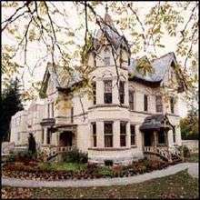
- Annandale House: 30 Tillson Ave. Annandale National Historic Site is one of the finest examples of the Aesthetic Art Movement, a Victorian style which utilized colour, decorative detail, and nature. Constructed in the 1880s for E.D. Tilson, the first mayor of Tillsonburg, Annandale NHS provides the opportunity to tour a restored period mansion and changing local history exhibits.
- Leachman Residence: 94 Rolph St. This Italianate-style house, with its rounded windows and eyebrow surrounds was built in 1876.
- Private Residence: 41 King St. Like many other buildings in Tillsonburg, this house was constructed of locally formed white brick. Decorative gingerbread under the eaves matches the gingerbread trim on the corner oriel windows.
- Private Residence: 101 Rolph St. This two storey Gothic-style house was built in 1880. Bay window projections on the front and side of the house combine with the striking two storey porch to create an inviting exterior. Of note are the wooden shutters that are shaped to fit each curved window.
- St. Paul's United Church Manse: 38 Ridout St. W. This two and a half storey house was built in 1870 as the manse for the adjacent United Church. The front facade presents an interesting combination of features with its delicate gingerbread in the gable, small dentil trim under the eaves, and rough stone window surrounds.
- Vivian House: 300 Broadway St. From the slate roof to the decorative stained glass, stylish gingerbread and detail work under the eaves, trim on the two storey porch, and unique keyhole window on a side elevation, this house is a wonderful example of Victorian elegance.
- T.W Gibson Residence:280 Broadway. In 1909 T.W Gibson started construction of a fine new brick residence which still stands as a stately home alone Tillsonburg's main tree line street.
Plaques and monuments
- Memorial Wall: 170 Broadway St. Plaque located in the Town Centre Mall. It memorializes various citizens' achievements.
- Tillsonburg Cenotaph: 170 Broadway St. The Cenotaph is located in the Town Centre Mall. This memorial is dedicated to Tillsonburg men and women who served in World Wars I and II.
- Rotary Clock Tower: 41 Bridge St W. Located at the corner of Bridge St and Broadway St. The clock came from the old Post Office, and the bell from the old Town Hall. The Tower is surrounded by memorial paving stones, engraved with the names of various prominent members of the community, as well as those designated by donors.
Cultural resources
- Great Western Railway Station: 41 Bridge St W. at corner of Bidwell St. The typical station roof lines of this building disclose its busy past. Note the spelling of Tilsonburg, with only one "l". The Baggage Room Gift Shop and Gallery, located in the former railway station, is operated by the Station Arts Centre. This train station was joined to the Lake Erie & Pacific Railway Station by adding the Changing Exhibit Gallery. Visitor Information site with brochures and maps for Ontario plus a computer kiosk was added in summer of 2013 for both tourist information and services for the Town of Tillsonburg.
- Theatre Tillsonburg: 14789 Potters Rd. Built in 1961. This is the former Hungarian Cultural Centre and was converted to a theatre in 1990.
- Tillson Pea and Barley Mill: 20 John Pound Rd. Originally an agricultural mill built in 1878, this three storey structure underwent a major reconstruction and reopened as The Mill Tales Inn and restaurant.
- Tillsonburg Lake Erie & Pacific Railway Station: 41 Bridge St W. Originally located on King St, but moved to its present location on Bridge St. in 1992. A gallery was built to join the original train station with this one. The two stations illustrate two distinct styles of railway station architecture. The Station Arts Centre is located in this building. Also home of the Farmers Market open from spring to Thanksgiving.
- Tillsonburg Public Library: 2 Library Lane. The Tillsonburg Public Library at Broadway and Washington Grand was built in 1974 replacing a Carnegie Library from 1915 built on the same site. The library joined the Oxford County library system on January 1, 2013 and the building has undergone a major renovation and re-opened on July 29, 2013. A mural of the former Carnegie Library is painted inside the library by local artist Ches Sulkowski. Two more murals are planned of the former Town Hall and one picturing a tobacco farm. The front of the building includes a paved area, with a paving stone for each of the Citizens of the Year designated by the Tillsonburg Chamber of Commerce. The stones begin with Harry Ostander, 1978. Each year, another stone is added for the current Citizen of the Year. Library Lane is also a paved area, with some memorial stones added as requested by donors. A plaque commemorates the founding of Tillsonburg and its founder, George Tillson, 1782-1864. This community, known as the Dereham Forge, grew around the sawmill and foundry that Tillson established. Plaque- Tillsonburg Public Library, 1975, plaque inside the building lists the library board, contractors and architects.
Natural areas and parks
- Coronation Park: Van St. 8 ha (20 acres) of parkland.
- Lake Lisgar Water Park: 45 Hardy Ave. Plaque - a plaque commemorating Barbara Ann Scott, Canadian gold medalist figure skater in 1950's. Plaque- In memory of Donald M. Gimbson, a prominent and community minded citizen who served as chairman of the parks and recreation commission and was instrumental in developing Tillsonburg's recreation facilities.
- Memorial Park: Ross T. Dixie Tribe Park. Plaque - The Dixie Tribe Memorial Park plaque was presented to the Town of Tillsonburg by H.M. Tribe Trumpour in memory of her son Dixie Tribe, 1941.
- VanNorman Memorial Park: A plaque to commemorate the VanNorman family, co-founders of the Town of Tillsonburg in the year 1825.Tillsonburg Tri-County Agricultural Society - a plaque for the Ontario Department of Agriculture presented this plaque in honour of J.M. Climie and in recognition of one hundred years of service by the Society on August 29, 1961.
- Participate Park: 41 Bridge St W. 10ha (25 acres) of parkland along Stoney Creek.
- Tillsonburg Conservation Area: Simcoe T 27 Hyman. Passive recreation. Part of the Long Point Region Conservation Authority.
References
- 1 2 3 2016 Census Profile
- ↑ Romanada, M. "Canada's top 100 trips (and you don't need a passport)", National Post, January 7, 2006.
- ↑ "Directory of Designations of National Historic Significance of Canada". Retrieved 2007-01-09.
- ↑ Population and dwelling counts, 2006 Census Statistics Canada (March 13, 2006). Retrieved on August 27, 2008.
- ↑ Population By Age. Tillsonburg, Ontario (table). 2006 Community Profiles. 2006 Census. Statistics Canada Catalogue no. 92-591-XWE. Ottawa. Statistics Canada (March 13, 2007). Retrieved on August 28, 2008.
- ↑ Population By Age. Oxford County, Ontario (table). 2006 Community Profiles. 2006 Census. Statistics Canada Catalogue no. 92-591-XWE. Ottawa. Statistics Canada (March 13, 2007). Retrieved on August 28, 2008.
- ↑ Population By Marital Status. Tillsonburg, Ontario (table). 2006 Community Profiles. 2006 Census. Statistics Canada Catalogue no. 92-591-XWE. Ottawa. Statistics Canada (March 13, 2007). Retrieved on August 28, 2008.
- ↑ Population By Marital Status. Oxford County, Ontario (table). 2006 Community Profiles. 2006 Census. Statistics Canada Catalogue no. 92-591-XWE. Ottawa. Statistics Canada (March 13, 2007). Retrieved on August 28, 2008.
- ↑ Population By Mother Tongue. Tillsonburg, Ontario (table). 2006 Community Profiles. 2006 Census. Statistics Canada Catalogue no. 92-591-XWE. Ottawa. Statistics Canada (March 13, 2007). Retrieved on August 28, 2008.
- ↑ Population By Mother Tongue. Oxford County, Ontario (table). 2006 Community Profiles. 2006 Census. Statistics Canada Catalogue no. 92-591-XWE. Ottawa. Statistics Canada (March 13, 2007). Retrieved on August 28, 2008.
- ↑ Population By Ethnicity. Tillsonburg, Ontario (table). 2006 Community Profiles. 2006 Census. Statistics Canada Catalogue no. 92-591-XWE. Ottawa. Statistics Canada (March 13, 2007). Retrieved on August 28, 2008.
- ↑ Population By Ethnicity. Oxford County, Ontario (table). 2006 Community Profiles. 2006 Census. Statistics Canada Catalogue no. 92-591-XWE. Ottawa. Statistics Canada (March 13, 2007). Retrieved on August 28, 2008.
- ↑ St. Thomas & Eastern
- ↑ Ontario Southland Railway
External links
Places adjacent to Tillsonburg | ||||||||||
|---|---|---|---|---|---|---|---|---|---|---|
| ||||||||||