Tichitt Airport
| Tichitt Airport | |||||||||||||||
|---|---|---|---|---|---|---|---|---|---|---|---|---|---|---|---|
| Summary | |||||||||||||||
| Airport type | Public | ||||||||||||||
| Serves | Tichit, Mauritania | ||||||||||||||
| Elevation AMSL | 561 ft / 171 m | ||||||||||||||
| Coordinates | 18°26′00″N 9°29′00″W / 18.43333°N 9.48333°WCoordinates: 18°26′00″N 9°29′00″W / 18.43333°N 9.48333°W | ||||||||||||||
| Map | |||||||||||||||
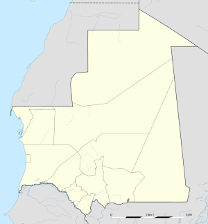 THI Location of the airport in Mauritania | |||||||||||||||
| Runways | |||||||||||||||
| |||||||||||||||
Tichitt Airport (IATA: THI, ICAO: GQNC) is an airport serving the town of Tichit in Mauritania. Runway boundaries are marked in white on dark rock or dirt; are otherwise difficult to discern.
See also

- Transport in Mauritania
- List of airports in Mauritania
References
- ↑ Airport information for Tichitt Airport at Great Circle Mapper.
- ↑ Google Maps - Tichit
External links
- OurAirports - Mauritania
- Great Circle Mapper - Tichit
- Tichit
- Accident history for Tichitt Airport at Aviation Safety Network
This article is issued from
Wikipedia.
The text is licensed under Creative Commons - Attribution - Sharealike.
Additional terms may apply for the media files.