Thenzawl
| Thenzawl | |
|---|---|
| town | |
| Nickname(s): Thenkhawpui | |
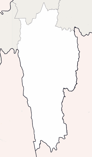 Thenzawl  Thenzawl | |
| Coordinates: 23°19′N 92°45′E / 23.32°N 92.75°ECoordinates: 23°19′N 92°45′E / 23.32°N 92.75°E | |
| Country | India |
| State | Mizoram |
| District | Serchhip |
| Elevation | 783 m (2,569 ft) |
| Population (2017) | |
| • Total | 10,147 |
| Languages | |
| • Official | Mizo |
| Time zone | UTC+5:30 (IST) |
| Vehicle registration | MZ |
| Climate | Cwa |
| Website | www.thenz.nic |
Thenzawl is a census town in Serchhip district in the Indian state of Mizoram. It is one of the most beautiful town in Mizoram. It is an important center for the traditional Mizo handloom industry.[1] Thenzawl is located at 90 km(56 miles) away from Aizawl, the capital of Mizoram.And also thenzawl toun is also called Naples of the East
History
Thenzawl was initially a dense forest with lots of wild animals before it was cultivated in 1961 and inhabited. Bengkhuaia Sailo established a village in 1963 in Thenzawl. Kamlova's son, Lalngurchhina was the last chief of Thenzawl. Due to the March 1966 Mizo National Front uprising, Thenzawl was one of the village where people were grouped together in 1968.
Geography
Thenzawl is located at 23°19′N 92°45′E / 23.32°N 92.75°E.[2] It has an average elevation of 783 metres (2568 feet).
Tourism
Tourist sites in the area include:
- Vantawng Falls - located 5 kilometres (3.1 mi) south of Thenzawl.[3]
- Bengkhuaia Thlan - the founder of Thenzawl Bengkhuaia invaded Alexandrapur in 1871 kidnapping Mary Winchester which brought about the British to Mizoram. He died around 1879.[4]
- Vaibiak - the place from where they took back Mary Winchester.[5]
- Tualvungi Thlan - There are two graves at Phulpui village in the Aizawl district of Mizoram India. It is said that, Zawlpala, Chief of Phulpui village, married the "legendary beauty", Talvungi of Thenzawl. Tualvungi was subsequently married to the chief of Rothai, Phuntiha. But, Talvungi could not forget Zawlpala, her previous husband. After many years when Zawlpala died, grief stricken Tualvungi came to Phulpui, dug a pit by the side of Zawlpala's grave and asked an old woman to kill her and bury her in the grave.
- Chawngchilhi Puk - a cave associated with a love story between a lady and a snake.[6][7][8]
- Tuirihiau - a beautiful waterfall near Thenzawl, upstream of Vantawng fall.[9]
- Thenzawl Deer Park - has 17 deers (11 female and 6 male) in natural environment.[10]
Media
The media in Thenzawl includes:[11]
Newspapers
- Vantawng
- Thenzawl Today
- Zawlbuk Aw
Cable TV
- Thenzawl Cable Network
- TS-Vision
Demographics
As of 2011 Indian census, Thenzawl had a population of 7529. Males constitute 49.8% of the population and females 50.2%. Female Sex Ratio is of 1007 against state average of 976. Moreover Child Sex Ratio in Thenzawl is around 915 compared to Mizoram state average of 970. Thenzawl has an average literacy rate of 98.1%, higher than the state average of 91.33%: male literacy is 98.07%, and female literacy is 98.23%. In Thenzawl, 13.58% of the population is under 6 years of age.
References
- ↑ One World South Asia
- ↑ Falling Rain Genomics, Inc - Thenzawl
- ↑ "Vantawng Falls". india9. Retrieved 2010-06-24.
- ↑ Vumson. "British Invasion of 1871". Zomi Library. Retrieved 1 September 2012.
- ↑ "Thenzawlah i kal dawn em?". vanglaini. Retrieved 1 September 2012.
- ↑ Rini Tochhong. "Chawngchilhi". Mizo writing in English. Retrieved 1 September 2012.
- ↑ "Chawngchilhi Puk". The Zozam Times. Retrieved 1 September 2012.
- ↑ wonderboy. "Chawngchilhi puk". misual.com. Retrieved 1 September 2012.
- ↑ Lalruatsanga. "photo". flickr. Retrieved 1 September 2012.
- ↑ "ENVIRONMENT & FOREST MINISTER-IN THENZAWL DEER PARK TLAWH". Mizoram DIPR. Retrieved 1 September 2012.
- ↑ "Accredited Journalists". DIPR Mizoram. Archived from the original on 19 June 2013. Retrieved 5 September 2012.
| State symbols | |
|---|---|
| Government | |
| Topics | |
| Districts | |
| Urban Areas | |
| Infrastructure | |
| Education | |
| Tourism | |
| Protected areas | |