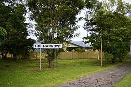
The Narrows, Northern Territory
| The Narrows Darwin, Northern Territory | |||||||||||||||
|---|---|---|---|---|---|---|---|---|---|---|---|---|---|---|---|
 | |||||||||||||||
| Population | 602 (2016 census)[1] | ||||||||||||||
| • Density | 2,000/km2 (5,200/sq mi) | ||||||||||||||
| Established | 1960s | ||||||||||||||
| Postcode(s) | 0820 | ||||||||||||||
| Area | 0.3 km2 (0.1 sq mi) | ||||||||||||||
| Location | 5.4 km (3 mi) from Darwin | ||||||||||||||
| LGA(s) | City of Darwin | ||||||||||||||
| Territory electorate(s) | Fong Lim | ||||||||||||||
| Federal Division(s) | Solomon | ||||||||||||||
| |||||||||||||||
The Narrows is a northern inner suburb of the city of Darwin, Northern Territory, Australia.
History
The Narrows gets its name from the name given to the narrow land between Ludmilla and Sadgrove Creeks.
The Narrows appeared on early plans of Darwin and was retained as a suburb name when the area of land south of the RAAF Base was subdivided in 1960.
References
- ↑ Australian Bureau of Statistics (27 June 2017). "2016 Community Profiles: The Narrows (State Suburb)". 2016 Census of Population and Housing. Retrieved 28 June 2017.

External links
| Wikimedia Commons has media related to The Narrows, Northern Territory. |
Coordinates: 12°25′40″S 130°51′38″E / 12.42778°S 130.86056°E
This article is issued from
Wikipedia.
The text is licensed under Creative Commons - Attribution - Sharealike.
Additional terms may apply for the media files.