Karama, Northern Territory
| Karama Darwin, Northern Territory | |||||||||||||||
|---|---|---|---|---|---|---|---|---|---|---|---|---|---|---|---|
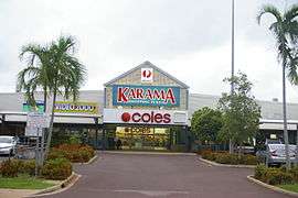 Karama Shopping Plaza | |||||||||||||||
| Population | 4,944 (2016 census)[1] | ||||||||||||||
| • Density | 2,350/km2 (6,100/sq mi) | ||||||||||||||
| Established | 1980s | ||||||||||||||
| Postcode(s) | 0812 | ||||||||||||||
| Area | 2.1 km2 (0.8 sq mi) | ||||||||||||||
| Location | 14.1 km (9 mi) from Darwin | ||||||||||||||
| LGA(s) | City of Darwin | ||||||||||||||
| Territory electorate(s) | Karama | ||||||||||||||
| Federal Division(s) | Solomon | ||||||||||||||
| |||||||||||||||
Karama is a Northern suburb of Darwin, Northern Territory, Australia.
History
The suburb of Karama is named after an Aboriginal tribe.
Karama is an established residential area in Darwin's northern suburbs built in the period from the late 1970s to the early 1980s.
The suburb is predominantly made up of residents of low socioeconomic status, with many homes being government housing. The suburb had problems with youth crime throughout the 1990s and 2000s, a youth criminal gang by the name of Karama Ghetto Boyz caused most of the problems. However, the situation has since improved and crime rates in Karama have gradually been decreasing throughout the 2010s.
In 1964, Douglas Lockwood recommended that a number of tribal names be used for the suburbs of Darwin. The suburbs Karama was listed.
Present day
Some major features of the area include the Karama Primary School, Manunda Terrace Primary School, Holy Family Primary School, O’Loughlin Secondary College and Karama Shopping Plaza.
Karama Library is also located within the Karama Shopping Plaza, and is a service of Darwin City Council Libraries.
Brazil Crescent in Karama was named after Robert Brazil, a crewman (fireman) on the ill-fated SS Gothenburg, which sank off the north Queensland coast on 24 February 1875, with the loss of approximately 102 lives. Brazil was one of only 22 survivors and was awarded a medal for bravery and heroism for his efforts to save drowning passengers.[2]
References
- ↑ Australian Bureau of Statistics (27 June 2017). "Karama(State Suburb)". 2016 Census QuickStats. Retrieved 28 June 2017.

- ↑ NT Government (2008). NT Place Names Register: Brazil Crescent. Retrieved online 2 February 2008.
External links
| Wikimedia Commons has media related to Karama, Northern Territory. |
- https://web.archive.org/web/20110629040718/http://www.nt.gov.au/lands/lis/placenames/origins/greaterdarwin.shtml#letter_h#k#k
- http://203.84.234.220/Profile/Darwin/Default.aspx?id=146&pg=101&gid=160&type=enum
Coordinates: 12°24′03.85″S 130°55′00.80″E / 12.4010694°S 130.9168889°E