Thamserku
| Thamserku | |
|---|---|
 Dole village and Mt. Thamserku (to the right) and Kangtega (to the left) in the background | |
| Highest point | |
| Elevation | 6,608 m (21,680 ft) [1] |
| Prominence | 623 metres (2,044 ft) |
| Coordinates | 27°47′25″N 86°47′15″E / 27.79028°N 86.78750°ECoordinates: 27°47′25″N 86°47′15″E / 27.79028°N 86.78750°E |
| Geography | |
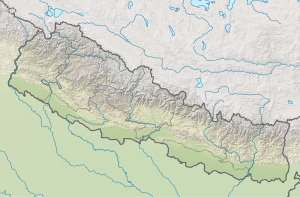 Thamserku Location in eastern Nepal | |
| Location | Khumbu, Nepal |
| Parent range | Himalayas |
| Climbing | |
| First ascent | 1964 by Lynn Crawford, Peter Farrell, John McKinnon, Richard Stewart[2] |
| Easiest route | snow/ice climb |

Thamserku, view from Khumjung
Thamserku is a mountain in the Himalayas of eastern Nepal. The mountain is connected by a ridge leading eastward to Kangtega. Thamserku is a prominent mountain to the east of Namche Bazaar and lies just north of Kusum Kangguru.
The first ascent was made in 1964 from the south by members of Edmund Hillary's Schoolhouse Expedition: Lynn Crawford, Pete Farrell, John McKinnon, Richard Stewart and Phu Dorje Sherpa. Below the basin on the southwest face, they reached the south ridge after climbing a difficult couloir. The team described the climb as difficult and the route has not been repeated in its entirety by anyone else.[2] In 2014, Russian climbers Alexander Gukov and Alexey Lonchinskiy made the first ascent on the southwest face.[2]
External links
| Wikimedia Commons has media related to Category:Thamserku. |
References
- ↑ Nepa Maps (Pvt.Ltd.), NE517: Everest Base Camp & Gokyo, Kathmandu, Nepal, 2013
- 1 2 3 Griffin, Lindsay (2015). "Thamserku, Southwest Face, Shy Girl". Climbs And Expeditions. American Alpine Journal. New York, NY, USA: American Alpine Club. 14 (89). Retrieved 2016-06-28.
This article is issued from
Wikipedia.
The text is licensed under Creative Commons - Attribution - Sharealike.
Additional terms may apply for the media files.