Tha Phae District
| Tha Phae ท่าแพ | |
|---|---|
| District | |
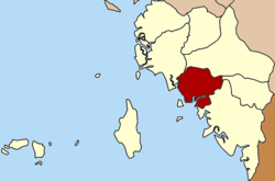 District location in Satun Province | |
| Coordinates: 6°47′24″N 99°58′12″E / 6.79000°N 99.97000°ECoordinates: 6°47′24″N 99°58′12″E / 6.79000°N 99.97000°E | |
| Country | Thailand |
| Province | Satun |
| Seat | Tha Phae |
| Area | |
| • Total | 197.25 km2 (76.16 sq mi) |
| Population (2005) | |
| • Total | 24,991 |
| • Density | 126.7/km2 (328/sq mi) |
| Time zone | UTC+7 (ICT) |
| Postal code | 91150 |
| Geocode | 9104 |
Tha Phae (Thai: ท่าแพ, pronounced [tʰâː pʰɛ̄ː]) is a district (amphoe) of Satun Province, southern Thailand.
History
The minor district (king amphoe) Tha Phae was established on 1 May 1976 with the two southwestern tambons, Tha Phae and Pae Ra of the district Khuan Kalong.[1] It was upgraded to a full district on 4 July 1994.[2]
Geography
Neighboring districts are (from the northwest clockwise) La-ngu, Khuan Kalong, Khuan Don and Mueang Satun. To the southwest is the Andaman Sea.
Administration
The district is divided into four sub-districts (tambons), which are further subdivided into 28 villages (muban). There are no municipal (thesaban) areas, and four tambon administrative organizations (TAO).
| No. | Name | Thai name | Villages | Pop. | Area (km²) | |
|---|---|---|---|---|---|---|
| 1. | Tha Phae | ท่าแพ | 9 | 8,570 | 57.62 | |
| 2. | Paera | แป-ระ | 6 | 5,116 | 36.94 | |
| 3. | Sakhon | สาคร | 7 | 7,018 | 67.18 | |
| 4. | Tha Ruea | ท่าเรือ | 6 | 4,287 | 50.21 |
References
- ↑ ประกาศกระทรวงมหาดไทย เรื่อง แบ่งท้องที่กิ่งอำเภอควนกาหลง อำเภอเมืองสตูล จังหวัดสตูล ตั้งเป็นกิ่งอำเภอท่าแพ (PDF). Royal Gazette (in Thai). 93 (80 ง): 1309. June 1, 1976.
- ↑ พระราชกฤษฎีกาตั้งอำเภอเปือยน้อย ... และอำเภอศรีวิไล พ.ศ. ๒๕๓๗ (PDF). Royal Gazette (in Thai). 111 (21 ก): 32–35. June 3, 1994.
External links
This article is issued from
Wikipedia.
The text is licensed under Creative Commons - Attribution - Sharealike.
Additional terms may apply for the media files.