Thérèse Island
 Thérèse Island | |
| Geography | |
|---|---|
| Location | Seychelles, Indian Ocean |
| Coordinates | 4°40′S 55°24′E / 4.667°S 55.400°ECoordinates: 4°40′S 55°24′E / 4.667°S 55.400°E |
| Archipelago | Inner Islands, Seychelles |
| Adjacent bodies of water | Indian Ocean |
| Total islands | 1 |
| Major islands |
|
| Area | 0.762 km2 (0.294 sq mi) |
| Length | 1.6 km (0.99 mi) |
| Width | 0.7 km (0.43 mi) |
| Coastline | 4.5 km (2.8 mi) |
| Highest elevation | 164 m (538 ft) |
| Highest point | Thérèse |
| Administration | |
| Group | Granitic Seychelles |
| Sub-Group | Mahe Islands |
| Sub-Group | Port Glaud Islands |
| Districts | Port Glaud |
| Largest settlement | Thérèse |
| Demographics | |
| Population | 0 (2014) |
| Pop. density | 0 /km2 (0 /sq mi) |
| Ethnic groups | Creole, French, East Africans, Indians. |
| Additional information | |
| Time zone | |
| ISO code | SC-21 |
| Official website |
www |
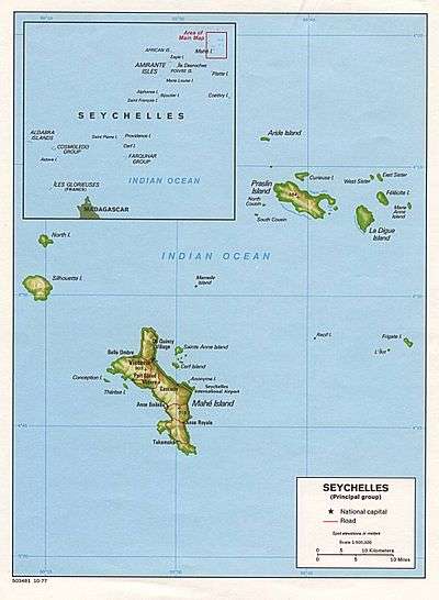
Thérèse Island is a small island off the western coast of Mahé in the Seychelles. It has 700 m long white sand beaches, with numerous coconut palms. It has two rocky peaks which resemble a giant's staircase, the tallest, Thérèse Peak, being 164 metres (538 feet) above sea level. There is a reef protecting the south shore of the island. Thérèse Island, along with its sister island Conception Island, is part of Port Glaud district of Mahé, the main island of the Seychelles.
The island is uninhabited but tourists frequently visit it for its water-sports including scuba diving, snorkeling, water skiing, sailing, windsurfing, and deep sea fishing.[1]
There is a restaurant on the island serving Creole cuisine.
Administration
The island belongs to Port Glaud District.[2] The island is for sale [3]
Tourism
Today, the island's main industry is tourism.
Image gallery
 Map 1
Map 1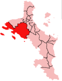 District Map
 Thérèse Island
References
- ↑ Carpin, Sarah,(1998) Seychelles, Odyssey Guides, p.158, The Guidebook Company Limited, Retrieved on June 22, 2008
- ↑ District map
- ↑ news
External links
| Wikimedia Commons has media related to Thérèse. |