Tennessee State Route 109
| ||||
|---|---|---|---|---|
| Route information | ||||
| Maintained by TDOT | ||||
| Length | 38.49 mi (61.94 km) | |||
| Major junctions | ||||
| South end |
| |||
|
| ||||
| North end |
| |||
| Location | ||||
| Counties | Wilson, Sumner | |||
| Highway system | ||||
| ||||

State Route 109 (SR 109) is a primary state highway in Middle Tennessee. It runs from the intersection of SR 265 and I-840 (Exit 72) near Lebanon, north through Gallatin to the Kentucky state line and US 31W.
SR 109 is mentioned in several country music songs including "Church on the Cumberland Road" by Shenandoah and "Goodbye Earl" by the Dixie Chicks. The first Cracker Barrel Restaurant was opened by Dan Evins at the corner of I-40 and SR 109 in Lebanon, Tennessee, in 1969.[1]
History
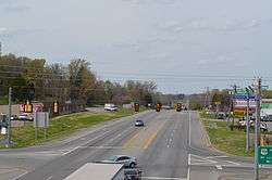
SR 109 originally ended at its interchange with US Highway 70, but was extended Southward to connect with Interstate 40 in 1968 and in the early 2000s to connect with State Route 265 and I-840. The highway is a four lane divided highway from I-840/SR 265 to Interstate 40 where it becomes a four lane non-divided highway to US Highway 70. It then becomes a two-lane highway until it intersects with Airport Road and South Water Ave. in Gallatin. At that point, SR 109 becomes a four lane divided highway once again and continues as a four lane divided highway to just south of the intersection of SR 109 and SR 76 in Portland. The highway continues as a 4 lane, non-divided highway to 2 miles north of downtown Portland where it becomes 2 lanes to US Highway 31W.
A new interchange was constructed in the mid-2000s with US 70, allowing for the free flow of traffic on US 70 with traffic signals controlling the exits onto SR 109. Prior to the reconstruction, US 70 eastbound traversed a long down-sloping hill to the at-grade intersection, which was a four-way stop until the early 2000s, before being converted to one using a standard traffic signal.
A bypass of downtown Gallatin was constructed in the 1990s, allowing traffic to divert around the city proper to the West. Control of the former 109 through town reverted to the city. In 2010, a newly-constructed four-lane divided section of the highway opened between Gallatin and Portland to replace the original narrow, curvy two-lane portion through the Highland Rim.
A four-lane bridge over the Cumberland River replaced the old two-lane bridge that was constructed in the 1950s and demolished in 2014.
Route description
Wilson County
SR 109 begins in southern Wilson County at an interchange with I-840 and SR 265 (Exit 72) near Gladeville. The highway heads north as a 4-lane divided highway, concurrent with SR 265, for a few hundred feet before SR 265 splits off and goes west. SR 109 then heads north to enter Lebanon and have an interchange with I-40 (Exit 232) and pass through a small business district, where it passes by the original Cracker Barrel. The highway then becomes undivided and continues north through rural areas before entering an industrial area and having an interchange with US 70/SR 24 in the Martha area before leaving Lebanon and narrowing to 2-lanes. SR 109 then passes through LaGuardo before crossing the Cumberland River into Sumner County.
Sumner County
SR 109 immediately enters Gallatin and widens to a 4-lane undivided highway and passes through a business district before coming to an intersection with Airport Road, where it turns left onto a bypass of downtown, where it becomes a divided highway once again. SR 109 then passes several neighborhoods before having an interchange with US 31E/SR 6. It then has an interchange with SR 174/SR 386 before having an at-grade intersection with SR 25 and leave Gallatin. SR 109 then passes through the mountains of the Highland Rim before entering Portland, where it becomes undivided and has an intersection with SR 76. The highway passes by several homes and businesses before having an intersection with SR 52 and passing through downtown. SR 109 then passes through an industrial area before narrowing to 2-lanes. The highway then passes through farmland before coming to its current end at a junction with US 31W/SR 41 near that route's junction with SR 259 just feet from the Kentucky state line.
Future
SR 109 is slated to be widened to a four-lane highway, with a middle 12' turn lane from Gallatin to I-40 in Lebanon, primarily for the increased level of traffic from the industrial park just off the Interstate. Plans are also underway for SR 109 to bypass downtown Portland and intersect with I-65. This project would extend SR 109 across US 31W to intersect with the interstate just south of the Tennessee-Kentucky border near Lake Springs Road in Robertson County. This project is currently in the construction phase.
Major intersections
| County | Location | mi | km | Destinations | Notes |
|---|---|---|---|---|---|
| Wilson | Lebanon | Southern terminus of SR 109; Southern end of SR 265 concurrency; I-840 exit 72 westbound; exit 72 A/B eastbound | |||
| Northern end of SR 265 concurrency | |||||
| I-40 exit 232 westbound; exit 232 A/B eastbound | |||||
| Interchange | |||||
| Sumner | Gallatin | South Water Avenue – Downtown Gallatin / Airport Road – Bledsoe Creek State Park, Sumner County Regional Airport | SR 109 turns westward, South Water Avenue and Airport Road are continuations | ||
| Interchange | |||||
| Interchange | |||||
| Portland | Eastern terminus of SR 76 | ||||
| Northern terminus of SR 109 | |||||
1.000 mi = 1.609 km; 1.000 km = 0.621 mi
| |||||
References
- ↑ "Cracker Barrel's Founder Dan Evins Dies At 76". WTVF. 2012-01-15. Archived from the original on 2012-01-18. Retrieved 2011-01-28.