Temperance River State Park
| Temperance River State Park | |
| Minnesota State Park | |
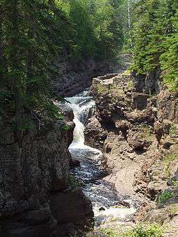 One of the park's waterfalls | |
| Country | |
|---|---|
| State | |
| County | Cook |
| Location | Tofte Township |
| - elevation | 663 ft (202 m) [1] |
| - coordinates | 47°33′15″N 90°52′20″W / 47.55417°N 90.87222°WCoordinates: 47°33′15″N 90°52′20″W / 47.55417°N 90.87222°W |
| Area | 5,059 acres (2,047 ha) |
| Founded | 1957 |
| Management | Minnesota Department of Natural Resources |
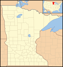 Location of Temperance River State Park in Minnesota | |
Temperance River State Park is a state park of Minnesota, USA, located between the communities of Schroeder and Tofte on Highway 61 on the North Shore of Lake Superior. It has campsites, picnic areas, and hiking trails on both sides of the Temperance River.
History
The Temperance River area was first permanently inhabited by Europeans in the 1830s. Settlers had to decide what to name various geographical features. When the geographical surveyors came through the area in 1864, they noticed that one particular river ran into water which was so deep that no sand bar formed at the mouth. Because there was no "bar" that river was named "Temperance."[2]
In the 1930s, the Civilian Conservation Corps built several overlooks at certain places along the riverside. In 1957, the state organized 539 acres (2.18 km2) of land into Temperance River State Park.
Attractions
Temperance River has two campgrounds, one on each side of the river. Both campgrounds are closer to Lake Superior than most state park campgrounds near the lake. Besides the "bar-less" mouth of the river, Temperance River has three waterfalls which can be reached by footpath. The park is also one of four Minnesota state parks to allow rock climbing, along with nearby Tettegouche State Park.
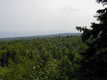
The Superior Hiking Trail passes through the park, following the river gorge before climbing to the top of Carlton Peak, nearly 1,000 feet (300 m) above Lake Superior.
References
- ↑ "Temperance River State Park". Geographic Names Information System. United States Geological Survey. 1991-05-01. Retrieved 2011-02-25.
- ↑ "A Sense Of Place - The Legacy of Names - Minnesota Conservation Volunteer: Minnesota DNR". Minnesota DNR. Archived from the original on 2007-07-01. Retrieved 2007-04-29.
External links
| Wikimedia Commons has media related to Temperance River State Park. |