Tembisa
| Tembisa Thembisa | |
|---|---|
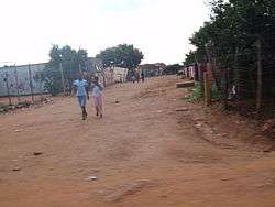 Tembisa township | |
 Tembisa  Tembisa Tembisa (South Africa)  Tembisa Tembisa (Africa) | |
| Coordinates: 26°00′20″S 28°12′37″E / 26.0055°S 28.2102°ECoordinates: 26°00′20″S 28°12′37″E / 26.0055°S 28.2102°E | |
| Country | South Africa |
| Province | Gauteng |
| Municipality | Ekurhuleni |
| Established | 1957 |
| • Councillor | (ANC) |
| Area[1] | |
| • Total | 42.80 km2 (16.53 sq mi) |
| Population (2011)[1] | |
| • Total | 463,109 |
| • Density | 11,000/km2 (28,000/sq mi) |
| Racial makeup (2011)[1] | |
| • Black African | 98.9% |
| • Coloured | 0.2% |
| • Indian/Asian | 0.1% |
| • White | 0.1% |
| • Other | 0.7% |
| First languages (2011)[1] | |
| • Northern Sotho | 33.1% |
| • Zulu | 21.7% |
| • Tsonga | 13.3% |
| • Xhosa | 7.0% |
| • Other | 24.9% |
| Time zone | UTC+2 (SAST) |
| Postal code (street) | 1632 |
| PO box | 1628 |
| Area code | 011 |
Tembisa is a large township situated to the north of Kempton Park on the East Rand, Gauteng, South Africa. It was established in 1957 when black people were resettled from Alexandra and other areas in Edenvale, Kempton Park, Midrand and Germiston.
Etymology
The name Thembisa is a Nguni word meaning promise and hope was later changed by Northern Sotho people who came from Limpopo to Tembisa, which has no meaning without the H. The settlement when it was founded carried with it a lot of hope and promise for a brighter future for its inhabitants. Though its initial residents were forcefully removed from parts of Kempton Park and Edenvale, for the purpose of clearing blacks from "white areas", settling in Tembisa also marked the end of years of harassment by apartheid authorities, and a reprieve from a life of squalor in their previous settlements.[2] Today Tembisa enjoys better infrastructure and its population has grown exponentially in the past 20 years, with its attraction being its location in the heart of Gauteng province's industrial zone.
History
The township was founded in 1957. After the Afrikaner-dominated National Party gained power in 1948 and began to implement apartheid, the pace of forced removals and the creation of townships outside legally designated white areas increased. The Johannesburg council established new townships for black people evicted from the city's freehold areas.
In 1956, townships were laid out for particular ethnic groups as part of the state's strategy to sift black people into groupings that would later form the building blocks of the so-called "independent homelands". It is the second largest township in Gauteng, following Soweto.
In 1977 the government initiated the Community Councils and in 1982 upgraded them to Town Councils, under the Black Local Authorities Act. The government vested limited powers on these councils but without financial muscle. Therefore, to raise revenue for purposes of developing the townships, the councils increased rent and service charges. This caused the residents in different townships, including Tembisa, to establish civic structures to resist the rent and service charge increases.[3]
In 2016, on July 25, residents were caught off guard when a tornado hit the area. The twister started in Kempton Park and moved over to Tembisa, causing the most destruction here. Around 20 people were severely injured and more than 400 were left homeless. One of the most visible sights was the damage to the Phumulani Mall, where the roof collapsed after the tornado passed through. No deaths were reported.
Transport
The township was not historically allowed to create employment centres within its area, so almost all of its residents commute daily to their employment destinations in places such as Kempton Park, Olifantsfontein, Pretoria Johannesburg and Midrand.
Rail
Metrorail operates commuter trains between Tembisa and central Johannesburg. Tembisa train stations are Tembisa in the east, Limindlela in the center and Leralla in the west. Oakmoor station is in the far east but is used by trains heading to Tshwane.
References
- 1 2 3 4 "Main Place Tembisa". Census 2011.
- ↑ "SAHA - South African History Archive - Establishment of Tembisa". www.saha.org.za. Retrieved 2018-05-03.
- ↑ "SAHA - South African History Archive - Tembisa in the 1980s - Civic structures". www.saha.org.za. Retrieved 2018-05-03.
Communities of Ekurhuleni, Gauteng | ||
|---|---|---|
Seat: Germiston | ||
| Places in Ekurhuleni | .svg.png) | |