Teemburra Dam
| Teemburra Dam | |
|---|---|
 | |
| Location | 53 km (33 mi) West of Mackay, Queensland |
| Coordinates | 21°11′19″S 148°40′01″E / 21.1885°S 148.667°ECoordinates: 21°11′19″S 148°40′01″E / 21.1885°S 148.667°E |
| Type | reservoir |
| Basin countries | Australia |
| Surface area | 1,107 ha (2,740 acres) |
| Max. depth | 54 m (177 ft) |
| Water volume | 147,500 ML (119,600 acre⋅ft)[1] |
| Surface elevation | 290 m (950 ft) |
| References | [1] |
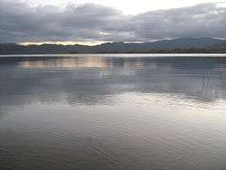
Teemburra Dam was constructed in 1997 for town water storage and irrigation purposes. It is located approximately 50 km west of Mackay, Queensland. It has a surface area of 1,040 hectares, an average depth of 14.2 metres and holds 147,500 Ml.
Fishing
A Stocked Impoundment Permit is required to fish in the dam.[2]

See also
References
Water supply in Queensland, Australia | |||||||||||||
|---|---|---|---|---|---|---|---|---|---|---|---|---|---|
| |||||||||||||
| |||||||||||||
This article is issued from
Wikipedia.
The text is licensed under Creative Commons - Attribution - Sharealike.
Additional terms may apply for the media files.