Omokoroa
| Omokoroa | |
|---|---|
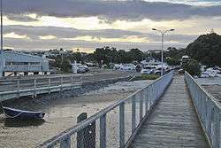 The sun setting at the Omokoroa wharf | |
 Omokoroa | |
| Coordinates: 37°40′00″S 176°01′58″E / 37.66667°S 176.03278°E | |
| Country |
|
| Region | Bay of Plenty |
| Territorial authority | Tauranga District |
| Ward | Kaimai |
| Population (2013) | |
| • Total | 2,547 |
Omokoroa is a small urban area in the Western Bay of Plenty District of New Zealand. The suburb is considered part of Greater Tauranga (contributing towards its population of 137,900), and is within the Bay of Plenty electorate.[1] Omokoroa began as a small rural holiday village, but is expanding to be a commuter town, with a 25-minute drive to Tauranga City.
Omokoroa itself had a population of 2547 as of 2013, but is now nearer 3000 after being now designated as an area of special housing growth. It is expected to reach a population of 12,000 by 2020-2030, and is situated within the Kaimai Ward, Western Bay of Plenty. Omokoroa includes the urban area on the harbour side of State Highway 2, along with Youngson Road to Plummers Point Road, and parts of Old Highway Road.
Tawhitinui Marae is located in the Omokoroa area. It is a marae (tribal meeting ground) of the Ngāti Ranginui tribe and its Pirirākau sub-tribe, and includes the Kahi wharenui (meeting house).[2][3]
Communication

The postcodes for the area are:
- 3114 - Railway line to harbour edge
- 3172 - Railway line towards SH2 [4]
The dialing prefix(es) for the town are
- (+64) 7 548
Education
The local primary school on the Omokoroa Peninsua is Omokoroa Point School (full primary) with Omokoroa No. 1 School on Plummers Point Road.
The nearest zoned secondary schools in the area are Otumoetai College, Tauranga Boys' College and Tauranga Girls' College. Katikati College and the private Bethlehem College are also nearby.
References
- ↑ "Electorate Boundaries". NZ Elections.
- ↑ "Te Kāhui Māngai directory". tkm.govt.nz. Te Puni Kōkiri.
- ↑ "Māori Maps". maorimaps.com. Te Potiki National Trust.
- ↑ Postcodes for the Western Bay of Plenty District