Taungup
| Taungup | |
|---|---|
| Town | |
_-_panoramio_(4).jpg) | |
 Taungup Location within Myanmar | |
| Coordinates: Coordinates: 18°51′N 94°14′E / 18.850°N 94.233°E | |
| Country |
|
| State |
|
| District | Thandwe District |
| Township | Taungup Township |
| Time zone | UTC+6:30 (MST) |
Taungup or Toungup or Toungok (Burmese: တောင်ကုတ်မြို့) is a principal town of the Taungup Township in the Rakhine State of westernmost part of Myanmar. It got 29.1 inches of rainfall on 21 July 2011.[1] It was record breaking and there was severe flooding.[2]
References
- ↑ http://www.mrtv3.net.mm/newpaper/227newsn.pdf%5Bpermanent+dead+link%5D Page 15 "Weather Forecast for 22nd July, 2011"
- ↑ mizzima.com/news/inside-burma/5650-seven-townships-in-arakan-state-flooded-by-record-heavy-rain.html
Capital: Sittwe | ||
| Kyaukpyu District |  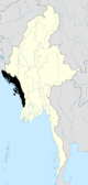 | |
| Maungdaw District | ||
| Sittwe District | ||
| Thandwe District |
| |
| Mrauk-U District | ||
| Main cities and towns | ||
This article is issued from
Wikipedia.
The text is licensed under Creative Commons - Attribution - Sharealike.
Additional terms may apply for the media files.