Tauber
| Tauber | |
|---|---|
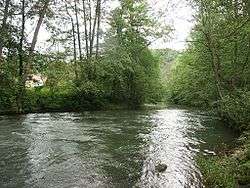 The Tauber near Waldenhausen (Wertheim am Main) | |
| Country |
|
| States | Baden-Württemberg, Bavaria |
| Reference no. | DE: 246 |
| Physical characteristics | |
| Main source |
near Weikersholz 447 m above sea level (NN) 49°15′00″N 10°06′53″E / 49.25°N 10.114861°ECoordinates: 49°15′00″N 10°06′53″E / 49.25°N 10.114861°E |
| River mouth |
near Wertheim am Main into the Main 136 m above sea level (NN) 49°45′48″N 9°30′49″E / 49.763389°N 9.513722°E |
| Length | 131.7 km (81.8 mi) [1] |
| Discharge |
|
| Discharge (location 2) |
|
| Discharge (location 3) |
|
| Discharge (location 4) |
|
| Basin features | |
| Progression | Main→ Rhine→ North Sea |
| Basin size | 1,809 km2 (698 sq mi) [1] |
| Landmarks |
|
The ![]()
It flows through Rothenburg ob der Tauber, Creglingen, Weikersheim, Bad Mergentheim, Königshofen, Tauberbischofsheim, and flows into the river Main in Wertheim am Main.
There is a medieval bridge over the river near Rothenburg ob der Tauber.
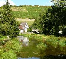
The Tauber and the vineyards between Rothenburg and Creglingen
References
- 1 2 Complete table of the Bavarian Waterbody Register by the Bavarian State Office for the Environment (xls, 10.3 MB)
This article is issued from
Wikipedia.
The text is licensed under Creative Commons - Attribution - Sharealike.
Additional terms may apply for the media files.