Tasiujaq Airport
| Tasiujaq Airport | |||||||||||
|---|---|---|---|---|---|---|---|---|---|---|---|
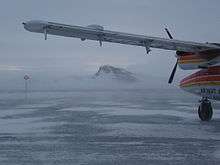 The airstrip of the Tasiujaq Airport | |||||||||||
| Summary | |||||||||||
| Airport type | Public | ||||||||||
| Operator | Administration Régionale Kativik | ||||||||||
| Location | Tasiujaq, Quebec | ||||||||||
| Time zone | EST (UTC−05:00) | ||||||||||
| • Summer (DST) | EDT (UTC−04:00) | ||||||||||
| Elevation AMSL | 121 ft / 37 m | ||||||||||
| Coordinates | 58°40′04″N 069°57′21″W / 58.66778°N 69.95583°WCoordinates: 58°40′04″N 069°57′21″W / 58.66778°N 69.95583°W | ||||||||||
| Map | |||||||||||
 CYTQ Location in Quebec | |||||||||||
| Runways | |||||||||||
| |||||||||||
| Statistics (2010) | |||||||||||
| |||||||||||
Tasiujaq Airport, (IATA: YTQ, ICAO: CYTQ), is located 1.5 nautical miles (2.8 km; 1.7 mi) southwest of Tasiujaq, Quebec, Canada.
Airlines and destinations
| Airlines | Destinations |
|---|---|
| Air Inuit | Aupaluk, Kangiqsujuaq, Kangirsuk, Kuujjuaq, Quaqtaq, Salluit |
References
- ↑ Canada Flight Supplement. Effective 0901Z 19 July 2018 to 0901Z 13 September 2018.
- ↑ Total aircraft movements by class of operation
External links
- Past three hours METARs, SPECI and current TAFs for Tasiujaq Airport from Nav Canada as available.
| By name | |
|---|---|
| By location indicator | |
| By province/territory | |
| By area | |
| National Airports System | |
| Related | |
| |
This article is issued from
Wikipedia.
The text is licensed under Creative Commons - Attribution - Sharealike.
Additional terms may apply for the media files.