Targówek
| Targówek | ||
|---|---|---|
| Warsaw District | ||
| ||
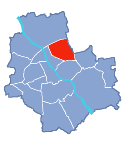 Location of Targówek within Warsaw | ||
| Coordinates: 52°16′56″N 21°03′51″E / 52.28222°N 21.06417°ECoordinates: 52°16′56″N 21°03′51″E / 52.28222°N 21.06417°E | ||
| Country |
| |
| Voivodeship | Masovian | |
| County/City | Warsaw | |
| Government | ||
| • Mayor | Sławomir Antonik | |
| Area | ||
| • Total | 24.37 km2 (9.41 sq mi) | |
| Population (2003) | ||
| • Total | 124,316 | |
| • Density | 5,100/km2 (13,000/sq mi) | |
| Time zone | UTC+1 (CET) | |
| • Summer (DST) | UTC+2 (CEST) | |
| Area code(s) | +48 22 | |
| Website | targowek.waw.pl | |

Targówek is a district in Warsaw, Poland located in the northern part of the city.
It is divided into two parts: residential and industrial. About 30% of the district's area is covered by municipal parks, such as Lasek Bródnowski, Park Bródnowski and Park Wiecha in the eastern part of the district. Between 1994 and 2002 Targówek was independent municipality.
Borders
Targówek borders with Praga Północ from west, with Białołęka from north, with Rembertów, Ząbki and Marki from east and with Praga Południe from south.
Neighbourhoods within the district
- Targówek Mieszkaniowy
- Targówek Fabryczny
- Bródno
- Bródno Podgrodzie
- Zacisze
- Elsnerów
- Utrata
| Wikimedia Commons has media related to Targówek. |
This article is issued from
Wikipedia.
The text is licensed under Creative Commons - Attribution - Sharealike.
Additional terms may apply for the media files.