Bemowo
| Bemowo | ||
|---|---|---|
| Warsaw District | ||
 The Bemowo District Hall | ||
| ||
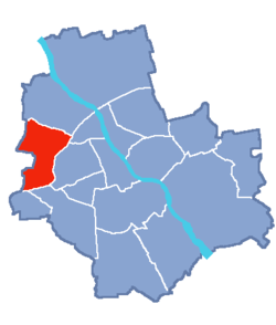 Location of Bemowo within Warsaw | ||
| Coordinates: 52°14′19″N 20°54′48″E / 52.23861°N 20.91333°ECoordinates: 52°14′19″N 20°54′48″E / 52.23861°N 20.91333°E | ||
| Country |
| |
| Voivodeship | Masovian | |
| County/City | Warsaw | |
| Government | ||
| • Mayor | Michał Grodzki | |
| Area | ||
| • Total | 24.95 km2 (9.63 sq mi) | |
| Population (2007) | ||
| • Total | 102,393 | |
| • Density | 4,100/km2 (11,000/sq mi) | |
| Time zone | UTC+1 (CET) | |
| • Summer (DST) | UTC+2 (CEST) | |
| Area code(s) | +48 22 | |
| Website | bemowo.waw.pl | |

Bemowo is a district of Warsaw located in the western part of the city. Its territory covers the western belt of the former district of Wola, which was incorporated to Warsaw in the year 1951. The name of the district derives from the surname of General Józef Bem.
Neighbourhoods within the district
- Lotnisko
- Fort Radiowo
- Boernerowo
- Bemowo Lotnisko
- Fort Bema
- Groty
- Górce
- Chrzanów
- Jelonki Północne
- Jelonki Południowe
International relations
Twin towns – Sister cities
Bemowo is twinned with:
References
- ↑ "Networks, town twinning and partnerships" (PDF). City of Solna. Retrieved 2013-08-04.
External links
- The official website of Bemowo
- A local info-website
- A local Internet newspaper for Bemowo
- Bemowo Pictures - Amateur movie group from Bemowo
| Wikimedia Commons has media related to Bemowo. |
This article is issued from
Wikipedia.
The text is licensed under Creative Commons - Attribution - Sharealike.
Additional terms may apply for the media files.