Tarata District
| Tarata | |||
|---|---|---|---|
| District | |||
| |||
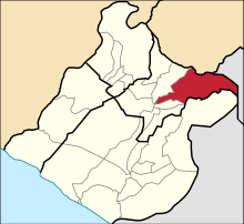 Location of Tarata in the Tarata Province | |||
| Country |
| ||
| Region | Tacna | ||
| Province | Tarata | ||
| Capital | Tarata | ||
| Government | |||
| • Mayor | José Luis Ticona Sanjinez | ||
| Area | |||
| • Total | 864.31 km2 (333.71 sq mi) | ||
| Elevation | 3,068 m (10,066 ft) | ||
| Population (2005 census) | |||
| • Total | 3,605 | ||
| • Density | 4.2/km2 (11/sq mi) | ||
| Time zone | UTC-5 (PET) | ||
| UBIGEO | 230401 | ||


Tarata District is one of eight districts of the province Tarata in Peru.[1]
Geography
The Barroso mountain range traverses the district. Some of the highest mountains of the district are listed below:[2]
- Antajawi
- Chaka
- Chunta Qullu
- Ch'uxñuma
- Inka Apachita
- Iñuma
- Juqhuri
- Khuruña
- Laram Qullu
- Lluqu Qullu
- Pä Qullu
- Phusnu Pullawi
- Tawa Qullu
- Titiri
- Wallatiri
- Warawarani
- Wila Qullu
- Wila Uqharani
- Wiqu
References
- ↑ (in Spanish) Instituto Nacional de Estadística e Informática. Banco de Información Distrital Archived 2008-04-23 at the Wayback Machine.. Retrieved April 11, 2008.
- ↑ escale.minedu.gob.pe - UGEL map of the Tarata Province (Tacna Region)
| |
|---|---|
| Candarave | |
| Jorge Basadre | |
| Tacna | |
| Tarata | |
This article is issued from
Wikipedia.
The text is licensed under Creative Commons - Attribution - Sharealike.
Additional terms may apply for the media files.