Tarō, Iwate
| Tarō 田老町 | ||
|---|---|---|
| Former municipality | ||
| ||
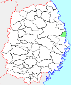 Location of Tarō in Iwate Prefecture | ||
 Tarō Location in Japan | ||
| Coordinates: 39°43′56″N 141°58′6″E / 39.73222°N 141.96833°ECoordinates: 39°43′56″N 141°58′6″E / 39.73222°N 141.96833°E | ||
| Country | Japan | |
| Region | Tōhoku | |
| Prefecture | Iwate Prefecture | |
| District | Shimohei | |
| Merged |
June 6, 2005 (now part of Miyako) | |
| Area | ||
| • Total | 101.05 km2 (39.02 sq mi) | |
| Population (June 1, 2005) | ||
| • Total | 3,535 | |
| • Density | 46.3/km2 (120/sq mi) | |
| Symbols | ||
| • Tree | Pinus densiflora | |
| • Flower | Lilium maculatum | |
| • Bird | Black-tailed gull | |
| Time zone | UTC+9 (JST) | |

Tarō (田老町 Tarō-chō) was a town located in Shimohei District, Iwate Prefecture in Japan, and forms part of the city of Miyako
History
The village of Tarō created on April 1, 1889 within Higashihei District with the establishment of the municipality system. Higashihei merged with Kitahei and Nakahei Districts to form Shimohei District on March 29, 1896. Tarō was raised to town status on April 1, 1944.
On June 6, 2005, Tarō, along with the village of Niisato (also from Shimohei District), was merged into the expanded city of Miyako and no longer exists as an independent municipality.
In June 2005, the town had an estimated population of 4,679 and a population density of 46.3 persons per km2. The total area was 101.05 km2.
The former town is located to the east of the prefectural capital Morioka and to the north of the regional center Miyako with which it has now merged. The area has a rugged coastline to the east, which is a part of Sanriku ria coast. The main local industry is commercial fishing.
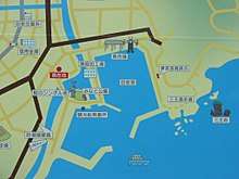
The town had been destroyed a number of times due to tsunami incidences all through its history. An early recorded one was in 1611, later in 1896 when 1,859 deaths were recorded, and another in 1933, when 911 people died.[1] Due to its history of repeated destruction by tsumanis, two layers of seawalls in the form of an X-shaped structure were constructed. The seawalls had two joined sections forming seaward and landward levees, and ran to a total of 2.4 km (1.5 mi) long. It was known as a Banri no Chojo, Japanese for "Great Wall of China".[2]
The 10 m (33 ft) high seawalls were completed in 1958 after 30 years of work to protect Tarō.[2] The seawalls, which could theoretically stop breaking waves up to 8 metres (26 ft) high, were designed to divert tsunamis to the sides around the town using channels and river dykes.[2] Local municipal agencies regularly carried out annual tsunami drills simulating an emergency. Volunteers would close the seawall gates and residents would go to muster points above the town. The system worked well when a tsunami from the 1960 Valdivia earthquake in Chile struck the town and there was no death reported in Tarō.[3]
2011 Tōhoku earthquake and tsunami
However, the seawalls failed when tsunami waves with height estimated to be 12 metres (39 ft) to 15 metres (49 ft) high struck Tarō following the earthquake and tsunami on March 11, 2011.[4][5] Survivors said they saw some residents climb on to the sea defences to watch the approaching tsunami only to be swept away when the waves went over the wall.[2] Many in the town said they felt the wall lulled them into a false sense of security.[6] A 500 m (1,600 ft) section of the seaside wall was swept away by the tsunami. Large amounts of concrete debris was left around Tarō and scattered in its bay.[7] 181 people were dead or missing in the tsunami, with nearly 1,700 houses damaged or destroyed.[8]
Four years after the tsunami, on 22 November 2015, a "town opening" ceremony was held in Tarō after the completion of 450 new houses. The new houses were built on higher ground some 40 to 60 meters above the sea level, as well as on ground that had been raised by about 2 meters. A 14.7-metre seawall was also rebuilt by 2017.[8][9] The population of the town however had dropped to 3,173, around 70 percent of the 2011 level.[8]
References
- ↑ "津波、10メートルの防潮堤越える…岩手県宮古・田老地区". 産経新聞. 2011-03-16. Archived from the original on 2011-03-19. Retrieved 2011-03-28.
- 1 2 3 4 "Japan's tsunami defences brutally exposed". AsiaOne. 26 March 2011. Retrieved 17 February 2013.
- ↑ "日本一の防潮堤、無念 大津波、圧倒的高さ 東日本大震災". Asahi Shimbun. 2011-03-20. Retrieved 2011-03-28.
- ↑ "A story of survival rises from the ruins of a fishing village". Toronto Star. 2011-03-15. Retrieved 2011-03-19.
- ↑ "38-meter-high tsunami triggered by March 11 quake: survey". Kyodo News. April 3, 2011. Retrieved 21 June 2011.
- ↑ "In Japan, Seawall Offered a False Sense of Security". New York Times. 31 March 2011. Retrieved 17 February 2013.
- ↑ "City's concrete 'protector' fails to stop killer tsunami". Asahi Shimbun. 21 March 2011. Archived from the original on 14 June 2013. Retrieved 17 February 2013.
- 1 2 3 "Tsunami fears haunt residents of recovering Iwate town". Japan Times. 29 November 2015.
- ↑ "大震災6年 手をつなぎ海に黙とう 岩手・宮古". Mainichi. 11 March 2017.
External links
- Official website of Miyako (in Japanese)
- Tarō sea wall before and after the tsunami by NHK
- Aerial views showing the extent of Tarō's coastal defences before March 2011
- Computer graphic showing the effects of the tsunami on Tarō.