Taoru
| Tauru | |
|---|---|
| Town | |
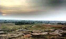 Tauru Landscape | |
 Tauru Location in Haryana, India  Tauru Tauru (India) | |
| Coordinates: 28°13′N 76°57′E / 28.22°N 76.95°ECoordinates: 28°13′N 76°57′E / 28.22°N 76.95°E | |
| Country |
|
| State | Haryana |
| District | Nuh District |
| Elevation | 262 m (860 ft) |
| Population (2011) | |
| • Total | 22,599 |
| Languages | |
| • Official | Hindi Haryanvi |
| Time zone | UTC+5:30 (IST) |
| PIN | 122105 |
| Telephone code | 01267 |
| ISO 3166 code | IN-HR |
| Vehicle registration | HR 96 |
| Website |
haryana |
Tauru is a town in Nuh district in the Indian state of Haryana.[1]
History
Taoru Tomb complex
Taoru Tomb Complex or Tauru Tomb Complex is a 3.5 acres (1.4 ha) walled tomb complex with 7 tombs, 2 of which has been restored by INTACH and Ansal University's Sushant School of Art and Architecture, of Tuglaq, Lodhi and Mughal architecture. It is rare in Delhi NCR region where multiple architectural styles of different eras are found in one complex itself.[2] The 1828 CE The Imperial Gazetteer of India of East India Company calls this area Lesser Balochistan, a likely reference to arrival of people from Balochistan during Lodhi era who might have been the rulers of Ferozepur Jhirka (a state which exited at least since Lodhi era which was later abolished by the British Raj in 1858 after the Rebellion of 1857) built these tombs during the successive dynasties. The largest tomb belongs to a Baloch.[3][4] The complex located on Taoru-Sohna section of NH 919 is only 12 kilometres (7.5 mi) from the Delhi-Jaipur NH48. It is 40 kilometres (25 mi) from Gurgaon and 70 kilometres (43 mi) from Delhi.
Geography
Taoru is located at 28°13′N 76°57′E / 28.22°N 76.95°E. It has an average elevation of 262 metres (859 feet). It is surrounded by Aravalli Range from three sides.
It is reached by road from Dharuhera town of Rewari district that lies on NH 48 and from Sohna town of Gurgaon district. The Rewari-Dharuhera-Bhiwadi-Taoru-Sohna-Palwal road is called National Highway 919 (NH 919).
Demographics
As of 2001 India census,[5] Taoru had a population of 17,227. Males constitute 53% of the population and females 47%. Taoru has an average literacy rate of 86.5%, higher than the national average of 69.5%: male literacy is 87%, and female literacy is 85%. In Taoru, 17% of the population is under 8 years of age.
Villages in Taoru tehsil
There are 84 villages in Taoru tehsil, namely:
Sikharpur, Buraka, Bhajlaka, Silkho, Chila, Sala-ka, Mala-ka, Mohmadpur, Pethredi, Hasanpur, Panchgaon, Chilawli, Charoda, Masit, Dhelamki, Nurpur, Bawla, Mandarka, Nanuka, Kangarka, Subasedi, Bhogipur, Didhara, Nijampur, Kalarpuri, Raniaki, Sewka, Gunawat, Chundika, Sunari, Khoire, Chote Khoire, Rathiwas, Uton, Jaurasi, Jhamwas, Fatepar, Kalwadi, Pada, Sekhpur, Gudha, Gudhi, Subras, Nanduki, Nigalgarh, Gogjaka, Goyla, Kalyaki, Sundh, Bhango, Jafrabad, Beri, Chahalka, Kharak Jalalpur, Khad Khadi, Rahadi, Nai Nangla, Dhulawat, Padheni, Khedki, Baghanki, Kota, Bissar, Sarai, Dadu, Dawla Pati, etc.
See also
References
- ↑ "Taoru (MC)". censusindia.gov.in. Government of India. Retrieved 17 April 2016.
- ↑ "A glorious heritage: INTACH profiles 600 monuments in love letter to historic Haryana.", Daily Mail, 7 June 2015.
- ↑ lalit Mohan, "The timeless tombs of Tauru.", The Tribune, 23 Feb 2002.
- ↑ "Tombs in Tauru - A Small Dusty Town."Tombs in Tauru - A Small Dusty Town, Delhipedia.
- ↑ "Census of India 2001: Data from the 2001 Census, including cities, villages and towns (Provisional)". Census Commission of India. Archived from the original on 2004-06-16. Retrieved 2008-11-01.
External links
- http://www.maplandia.com/india/haryana/gurgaon/ by sourabh bansal(S.B.), Chicago
- http://secharyana.nic.in/html/PSRESULTPDF/TAORU.pdf by S.B.
- http://secharyana.nic.in/html/MCresultpdf/taoru.pdf by S.B.
- https://web.archive.org/web/20071107080423/http://haryanatourism.com/pilgrim/surjivanfarm.asp by S.B.
- elections
- http://heritagetransportmuseum.org/
- http://www.hindustantimes.com/punjab/chandigarh/tauru-turns-into-political-hotspot-as-haryana-assembly-polls-approach/article1-1227595.aspx%5Bpermanent+dead+link%5D