Tamarugal Province
| Tamarugal Province Provincia de Tamarugal | ||
|---|---|---|
| Province | ||
| ||
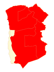 Location in the Tarapacá Region | ||
 Tamarugal Province Location in Chile | ||
| Coordinates: 20°15′34″S 69°47′10″W / 20.25944°S 69.78611°WCoordinates: 20°15′34″S 69°47′10″W / 20.25944°S 69.78611°W | ||
| Country |
| |
| Region |
| |
| Capital | Pozo Almonte | |
| Communes |
List of 5:
| |
| Government[1] | ||
| • Type | Provincial | |
| • Governor | Luis Tobar Toledo (EVOP) | |
| Area[2] | ||
| • Total | 39,390.5 km2 (15,208.8 sq mi) | |
| Area rank | 1 | |
| Population (2012 Census)[2] | ||
| • Total | 20,053 | |
| • Rank | 2 | |
| • Density | 0.51/km2 (1.3/sq mi) | |
| • Urban | 11,876 | |
| • Rural | 10,655 | |
| Sex[2] | ||
| • Men | 14,175 | |
| • Women | 8,356 | |
| Time zone | UTC-4 (CLT [3]) | |
| • Summer (DST) | [[UTC-3 ] postal_code_type =]] (CLST [4]) | |
| Area code(s) | 56 + 57 | |
| Website | Government of Tamarugal | |

Tamarugal Province (Spanish: Provincia de Tamarugal) is one of two provinces in the northern Chilean region of Tarapacá (I). The capital is the city of Pozo Almonte.
Name
The province is named after Pampa del Tamarugal. Spanish name:
- Provincia de Tamarugal: Used by the government of the province.
- Provincia del Tamarugal: Used by the government of Chile.[5] Derived from the name El Tamarugal.
- Provincia El Tamarugal: Derived from the name El Tamarugal.
Geography and demography
According to the 2002 census by the National Statistics Institute (INE), the province spans an area of 39,390.5 km2 (15,209 sq mi) and had a population of 22,531 inhabitants (14,175 men and 8,356 women). It is the seventh largest and ninth least populated province in the country with a population density of 0.6/km2 (2/sq mi). Between the 1992 and 2002 censuses, the population grew by 63.5% (8,748 persons).[2]
Administration
The province is administered by a presidentially appointed governor. Luis Tober Toledo was appointed by president Sebastian Piñera.
Communes
As a province, Tamarugal is a second-level administrative division of Chile, which is further subdivided into five communes (comunas).
| Commune | Area (km2)[2] | 2002[2] population |
Density (km2) | Government website[6] |
|---|---|---|---|---|
| Pozo Almonte (Capital) | 13,765.8 | 10,830 | 0.8 | link |
| Pica | 8,934.3 | 6,178 | 0.7 | link |
| Huara | 10,474.6 | 2,599 | 0.2 | link |
| Colchane | 4,015.6 | 1,649 | 0.4 | link |
| Camiña | 2,200.2 | 1,275 | 0.6 | none |
| Province | 39,390.5 | 22,531 | 0.6 | link |
References
- ↑ "Gobierno de Chile: Gobernadores". Government of Chile (in Spanish). Archived from the original on 7 July 2011. Retrieved 18 March 2011.
- 1 2 3 4 5 6 "Territorial division of Chile" (PDF) (in Spanish). National Statistics Institute. 2007. Retrieved 18 March 2011.
- ↑ "Chile Time". WorldTimeZones.org. Archived from the original on 11 September 2007. Retrieved 26 September 2010.
- ↑ "Chile Summer Time". WorldTimeZones.org. Archived from the original on 11 September 2007. Retrieved 26 September 2010.
- ↑ http://www.minjusticia.gob.cl/n7361_02-06-2015.html
- ↑ "Asociacion Chilena de Municipalidades" (in Spanish). Archived from the original on 19 April 2011. Retrieved 18 March 2011.
External links
- (in Spanish) Government of Tamarugal
