Malleco Province
| Malleco Province Provincia de Malleco | ||
|---|---|---|
| Province | ||
| ||
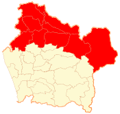 Location in the La Araucanía Region | ||
 Malleco Province Location in Chile | ||
| Coordinates: 38°15′S 72°15′W / 38.250°S 72.250°WCoordinates: 38°15′S 72°15′W / 38.250°S 72.250°W | ||
| Country | Chile | |
| Region | La Araucanía | |
| Capital | Angol | |
| Communes | ||
| Government | ||
| • Type | Provincial | |
| • Governor | Víctor Manoli Nazal (RN) | |
| Area[1] | ||
| • Total | 13,433.3 km2 (5,186.6 sq mi) | |
| Population (2012 Census)[1] | ||
| • Total | 196,190 | |
| • Density | 15/km2 (38/sq mi) | |
| • Urban | 139,261 | |
| • Rural | 43,801 | |
| Sex[1] | ||
| • Men | 100,227 | |
| • Women | 101,388 | |
| Time zone | UTC-4 (CLT[2]) | |
| • Summer (DST) | UTC-3 (CLST[3]) | |
| Area code(s) | 56 + 45 | |
| Website | Government of Malleco | |

Malleco Province (Spanish: Provincia de Malleco) is one of two provinces in the southern Chilean region of La Araucanía (IX). Its population as of the 2012 census, is 196,190, and it covers an area of 13,433.3 km2 (5,187 sq mi). The provincial capital is the city of Angol.
Malleco Province is known for having the emblematic Malleco Viaduct and the Las Raíces Tunnel, Chile's longest tunnel that links the eastern part of Malleco province to the rest of the province.
Communes
As one of Chile's second level administrative divisions, Malleco comprises eleven communes, each administered by its respective municipality.
Geography and demography
According to the 2002 census by the National Statistics Institute (INE), the province spans an area of 13,433.3 km2 (5,187 sq mi)[1] and had a population of 201,615 inhabitants (100,227 men and 101,388 women), giving it a population density of 15/km2 (39/sq mi). Of these, 139,261 (69.1%) lived in urban areas and 43,801 (21.7%) in rural areas. Between the 1992 and 2002 censuses, the population fell by 0.7% (1,422 persons).[1]
Malleco Valley wine region
Located 340 miles (540 km) south of the capital of Chile, Santiago, the Malleco wine region lies in the province of the same name. It is one of Chile’s southern Denomination of Origin (DO) regions as defined by the Chilean Appellation system, the legally protected geographical indication used to identify where the grapes for a wine were grown. The wine industry here is still developing but good results are already being obtained, particularly from its crispy and fresh Chardonnay and Pinot Noir. The climate is cool, with a high level of rainfall (51 inches (1300 mm) a year), a short growing season, and high temperature variation between day and night, which is challenging for wine producers. Most vineyards are located around the town of Traiguen, just south of the Bio Bio Valley. The volcanic soil in Malleco, composed mainly of sand and clay, are reasonably well drained. Although the valley has high rainfall, vines have to make extra effort to hydrate due to the well-drained soil, which results in less foliage and lower grape yields.[4] All these factors produce grapes with more concentrated flavour and excellent structure, which in turn leads to the crisp and fresh wine produced in the region.
Grape distribution by varietal
- Climate: Cool Mediterranean climate. 1300 mm (51.2 in) of rain per year.
- Soils: Volcanic soils, clay and sand.
- Primary wines: Chardonnay and Pinot Noir.
| Sauvignon Blanc: 3 ha (7 acres) | Chardonnay: 3 ha (7 acres) | Pinot Noir: 4 ha (10 acres) | Gewürztraminer: 1 ha (2 acres) |
Total hectares planted: 11 ha (27 acres).[5]
See also
References
![]()
- 1 2 3 4 5 "Territorial division of Chile" (PDF) (in Spanish). National Statistics Institute. 2007. Archived from the original (PDF) on 14 November 2010. Retrieved 18 March 2011.
- ↑ "Chile Time". WorldTimeZones.org. Archived from the original on 2007-09-11. Retrieved 2010-07-28.
- ↑ "Chile Summer Time". WorldTimeZones.org. Archived from the original on 2007-09-11. Retrieved 2010-07-28.
- ↑ Malleco Valley Wine http://www.wine-searcher.com/ Published by Wine-Searcher.com | Last updated 09-Aug-2013 by Wine-Searcher Staff retrieved October 7, 2013
- ↑ See Itata Valley Chart Archived 2013-12-02 at the Wayback Machine. www.winesofchile.org all right reserved, retrieved September 23, 2013/
